Area Overview for Knaresdale with Kirkhaugh
Photos of Knaresdale with Kirkhaugh
Area Information
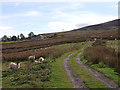
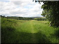
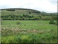
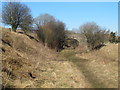
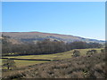
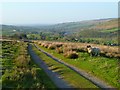
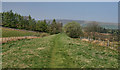
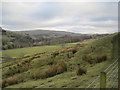
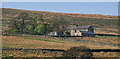
Knaresdale with Kirkhaugh occupies the south-western extremity of Northumberland, comprising a civil parish that spans 90.2 square kilometres. This remote location places the community at the convergence of historic boundaries, bounded to the north and west by Knaresdale and to the south by Alston parish. The area presents a distinctly rural lifestyle for anyone considering homes in Knaresdale with Kirkhaugh. Current records indicate a population of approximately 1,002 residents, creating a very small-scale community where neighbours are likely to be long-standing acquaintances. The postcode CA6 7NT serves as the central identifier for this stretch of the North East England landscape. Settlement patterns here have evolved over centuries; while Roman occupation ended in AD 410, the area retained its Anglo-Saxon character for generations. An Anglo-Saxon stone cross remains visible within the Kirkhaugh churchyard, marking a tangible link to the past. You will find that daily life in this parish is defined by its rural isolation and deep historical roots rather than modern urban convenience. The consistent presence of historical structures suggests a property market where significant buildings feature prominently in the local skyline.
- Area Type
- Parish
- Area Size
- 90.2 km²
- Population
- Not available
- Population Density
- Not available
Demographics
The community profile of Knaresdale with Kirkhaugh reveals a settlement with a substantially older population. Statistics show a median age of 70 years, distinguishing this parish from more typical retirement destinations or family hubs. This demographic skew indicates that the area currently attracts senior residents seeking a quiet, rural existence away from the busy centres of Northumberland. Home ownership stands at a solid 60 per cent, meaning that nearly two out of every three households own their property outright. This high rate of ownership often suggests financial stability among residents who have chosen to put down roots in the parish. Accommodation types and overall household composition reflect this established nature, with a significant portion of the 1,002 total population living in permanent resident homes rather than seasonal dwellings. The area maintains a homogenous character typical of rural North East England, with specific ethnic and religious data not provided in available records. Living in Knaresdale with Kirkhaugh means participating in a community where the social fabric is tightly woven around a predominantly older demographic. This environment offers tranquility but may lack the vibrancy or youthful energy found in larger towns.
Household Size
Accommodation Type
Tenure
Ethnic Group
Religion
Household Composition
Age
Household Deprivation
NS-SEC
Explore more demographic insights in this area
Go to Demographics tabPlanning
Planning Constraints
- Flood RiskPremium
- Ramsar Wetland SitesPremium
- Area of Outstanding Natural BeautyPremium
- Protected Nature ReservePremium
- Protected WoodlandPremium
- Crime RiskPremium