Area Overview for Jarrow
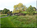
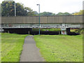
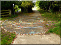
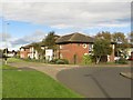
Photos of Jarrow


Area Information
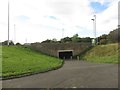
Jarrow is a built-up area covering 7.9 square kilometres in the Hartlepool district of England. Residents live in a compact environment where local facilities are within immediate reach. The area presents itself as a traditional working-class community with a distinct local identity. Daily life here revolves around proximity to major retail chains and public transport hubs rather than expansive green spaces. You will find a neighbourhood where the pace of life aligns with standard industrial town rhythms. Most people commute to nearby employment centres or utilize local opportunities. The character of Jarrow is defined by its accessible infrastructure and established residential patterns. Shopping trips require minimal travel distance as major supermarkets sit nearby. Public transport links connect you quickly to Newcastle and surrounding regions. Families often rely on these transport arteries for their daily movements. The area offers a straightforward living situation without the luxury of extensive recreational amenities. Homeownership remains a significant factor in this landscape, with roughly half of residents owning their properties. This snapshot provides a clear view of a functional residential zone suitable for those seeking practicality over novelty.
- Area Type
- Built Up Area 250
- Area Size
- 7.9 km²
- Population
- Not available
- Population Density
- Not available
Daily life in Jarrow is supported by a practical array of amenities within easy reach. Five retail outlets, including Tesco South, Morrisons Daily, and another Morrisons Daily, satisfy grocery and shopping needs. You can visit these shops for routine purchases without travelling far. Public transport accessibility extends through five metro routes and three railway stations covering Brockley Whins, East Boldon, and Heworth. These connections integrate seamlessly with your daily travel plans. Additionally, two ferry terminals offer New Castle International and South Shields connections for coastal commuters. One designated bus stop at Rhodes Street serves local shorter journeys. This density of services means you manage all daily tasks with minimal effort. There is no data on parks, leisure centres, or dining venues in the immediate vicinity. The focus remains firmly on essential transport and retail infrastructure. Bedrooms benefit from immediate access to supermarkets and train stations. This lifestyle prioritises efficiency and routine over leisurely exploration of local attractions. You find everything you need for standard living within a short radius. The absence of listed leisure facilities suggests a functional rather than vibrant social scene. Residents must look beyond the immediate listed amenities for dining or recreation options. The convenience of having supermarkets and rail hubs nearby defines the local experience.
Amenities
Schools
Families in Jarrow have access to a specific cluster of educational institutions within the immediate vicinity. Clervaux Nursery School and Dunn Street Nursery School provide early years care for young children. Monkton Junior School and Monkton Infants School form a paired foundation stage within the local educational geography. Bede Burn Primary School stands out as an options for younger students, holding a good Ofsted rating. This mix offers practical choices for parents moving to the area. You will find one primary school with a verified good rating alongside several nurseries and infant/junior divisions. The presence of multiple nursery schools indicates some support for early childhood development. However, the data does not list secondary schools nearby, so older children likely commute further afield. This school configuration suggests the local area serves as a home base for pre-primary education specifically. Parents moving here for schooling purposes should verify secondary options independently, as none are listed in the local proximity data. The good rating at Bede Burn Primary School provides a clear starting point for evaluating educational quality. This school profile supports families who have completed early years education locally but may need to look outward for later stages. The limited list of schools defines the immediate educational convenience for residents.
| Rank | School | Type | Entry gender | Ages |
|---|
Explore more schools in this area
Go to Schools tabDemographics
The community in Jarrow features a significant demographic skew towards older residents. With a median age of 70, this area hosts one of the oldest populations in the region. The most common age range encompassing the total population reflects this established settlement pattern. Fifty-two percent of residents own their homes, indicating a stable, owner-occupied market. The remaining households represent long-term tenants or those in mixed tenure arrangements. There are no specific statistics available regarding household composition metrics or predominant ethnic groups within the provided information. You cannot access details on religion or specific accommodation type breakdowns from the available figures. This age profile suggests a population that has aged in place rather than absorbing younger migrants. The lack of younger demographic data highlights a shift away from the area's previous industrial workforce. When evaluating living in Jarrow, you must account for a neighbour base comprised largely of retirees. This concentration influences local services and the general social atmosphere. The area does not cater specifically to young families or new professionals based on these figures. Understanding this age structure is essential for buyers seeking a specific demographic environment.
Household Size
Accommodation Type
Tenure
Ethnic Group
Religion
Household Composition
Age
Household Deprivation
NS-SEC
Explore more demographic insights in this area
Go to Demographics tabPlanning
Planning Constraints
- Crime RiskPremium