Area Overview for Ingleby Barwick South Ward
Photos of Ingleby Barwick South Ward
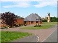
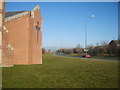
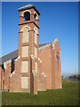
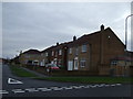
7 photos from this area
Area Information
Write an engaging overview of living in Ingleby Barwick South Ward. Cover what makes this area distinctive, who lives here, and what daily life is like. Weave in the population, area size, and any background context naturally. This is the first thing a prospective homebuyer reads — make it count.
- Area Type
- District Borough Unitary Ward
- Area Size
- 2.9 km²
- Population
- 1359
- Population Density
- 463 people/km²
Demographics
Describe the community in Ingleby Barwick South Ward. Cover the age profile, household types, home ownership levels, accommodation types, and diversity using the exact figures provided. Present deprivation data in context — explain what it means for quality of life. Every claim must reference a specific number from the data.
Household Size
total
most common
Accommodation Type
total
most common
Tenure
85
majority
Ethnic Group
total
most common
Religion
total
most common
Household Composition
total
most common
Age
70
median
Age: Total
most common
Household Deprivation
N/A
with no deprivation
NS-SEC
40
in Lower managerial occupations
Explore more demographic insights in this area
Go to Demographics tabPlanning
Planning Constraints
- Flood RiskPremium
- Ramsar Wetland SitesPremium
- Area of Outstanding Natural BeautyPremium
- Protected Nature ReservePremium
- Protected WoodlandPremium
Explore more planning insights in this area
Open Planning mapFrequently Asked Questions
Question about Ingleby Barwick South Ward?
Direct, factual answer using the provided data. 30-80 words.