Area Overview for Ingleby Barwick
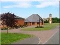
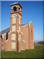
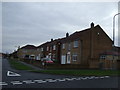
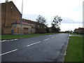
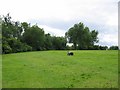
Photos of Ingleby Barwick

Area Information
Ingleby Barwick, a built-up area spanning 4.6 km² in England, offers a compact yet functional living environment for those seeking a quieter, community-focused lifestyle. With a median age of 70, the area reflects a demographic skewed toward older residents, suggesting a mature, stable population. The high home ownership rate of 84% indicates a strong sense of local investment and long-term residency. Daily life here is shaped by proximity to essential services and transport links. The area’s low crime risk, with a safety score of 82, adds to its appeal for families and retirees. While not a sprawling city, Ingleby Barwick’s size allows for a balance between accessibility and a slower pace of life. Its location near major transport hubs, including rail stations and airports, ensures connectivity without the congestion of larger urban centres. For those prioritising safety, affordability, and a settled community, Ingleby Barwick presents a compelling case for homeownership.
- Area Type
- Built Up Area 250
- Area Size
- 4.6 km²
- Population
- Not available
- Population Density
- Not available
Living in Ingleby Barwick provides access to a range of amenities that cater to daily needs and leisure. The area’s retail sector includes major chains such as Tesco Ingleby, Co-op Ingleby, and Asda Yarm, ensuring grocery and household shopping is easily accessible. Rail stations like Eaglescliffe, Allens West, and Yarm offer convenient links to nearby towns and cities, while the proximity to Durham Tees Valley Airport and the Transporter Bridge North Side ferry service adds flexibility for travel. Though the data does not specify parks or recreational facilities, the presence of multiple retail and transport hubs suggests a lifestyle focused on practicality and connectivity. Residents can enjoy a balance of local convenience and broader regional access, making Ingleby Barwick suitable for those who value accessibility without sacrificing a sense of community.
Amenities
Schools
Ingleby Barwick is served by several primary schools, including Whinstone Primary School, Ingleby Mill Primary School (rated ‘good’ by Ofsted), St Therese of Lisieux Primary School, Myton Park Primary School (also rated ‘good’), and All Saints CofE School. The presence of multiple primary schools within close proximity ensures that families have options, though no secondary schools are listed in the data. The two schools with ‘good’ Ofsted ratings indicate a baseline quality of education, though parents may need to consider additional factors such as school catchment areas and specific curricula. For families prioritising primary education, the variety of schools available supports a range of educational preferences, from state-run institutions to faith-based schools.
| Rank | A + A* % | School | Type | Entry gender | Ages |
|---|---|---|---|---|---|
| 1 | N/A | Whinstone Primary School | primary | N/A | N/A |
| 2 | N/A | Ingleby Mill Primary School | primary | N/A | N/A |
| 3 | N/A | St Therese of Lisieux Primary School | primary | N/A | N/A |
| 4 | N/A | Myton Park Primary School | primary | N/A | N/A |
| 5 | N/A | All Saints CofE School | primary | N/A | N/A |
Explore more schools in this area
Go to Schools tabDemographics
Ingleby Barwick’s population is characterised by a median age of 70, with the most common age range encompassing the total population. This suggests a community where older residents form a significant proportion, likely reflecting a mix of retirees and long-term residents. Home ownership is exceptionally high at 84%, indicating that the majority of residents own their properties rather than rent. The data does not specify household composition or diversity, but the absence of detailed figures means no assumptions can be made about family structures or ethnic composition. The area’s demographics point to a stable, low-turnover population, which may influence local services and amenities. For prospective buyers, the high home ownership rate and older demographic profile suggest a neighbourhood with established roots and a focus on long-term residency.
Household Size
Accommodation Type
Tenure
Ethnic Group
Religion
Household Composition
Age
Household Deprivation
NS-SEC
Explore more demographic insights in this area
Go to Demographics tabPlanning
Planning Constraints
- Crime RiskLocked