Area Overview for Hunwick
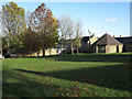
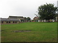
Photos of Hunwick


Area Information
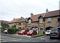
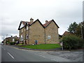
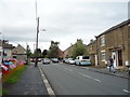
Hunwick is a built-up area covering 32.8 hectares in the heart of County Durham, England. Residents here typically value a rural setting without sacrificing practical access to larger towns. The community feels established, with a median age of 70 indicating a significant population of older homeowners. This demographic shape suggests a quieter neighbourhood where pace of life remains moderate. Living in Hunwick means you are part of a settlement designed around long-term settlement rather than transient housing. You do not experience the congestion typical of major cities, yet you remain connected to wider transport networks. The location balances isolation with accessibility, offering a retreat from busy urban centres while keeping rail links nearby. Many families and retirees choose this area for its stability and established character. Daily life revolves around local routines supported by nearby retail and rail connections. The sheer size of the area creates a distinct boundary that separates Hunwick from surrounding open land. This defined character gives the area a sense of place that attracts those seeking a settled environment.
- Area Type
- Built Up Area 250
- Area Size
- 32.8 hectares
- Population
- Not available
- Population Density
- Not available
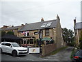
Daily life in Hunwick is supported by a small network of local amenities within practical reach. Residents have access to five retail outlets, including Spar Bridge, Co-op Commercial, and Spar Willington. These shops form the core of local commerce, offering groceries and essentials close to your front door. You do not need to travel far for daily shopping needs, which adds convenience to your routine. Three railway stations lie nearby, providing vital links to Bishop Auckland West Weardale Railway Station, Bishop Auckland Railway Station, and Shildon Railway Station. These train lines allow easy access to larger towns and employment hubs for commuters. The proximity to BAME and Bishop Auckland enables trips for larger purchases or leisure without spending the whole day travelling. While dining and leisure venues outside retail are not listed, the rail network opens possibilities for accessing attractions elsewhere. The combination of local Spar stores and national rail stations balances convenience with connectivity. You get the ability to run errands locally while retaining easy travel options when required. This mix supports a lifestyle that values both stability and occasional longer journeys.
Amenities
Schools
Hunwick has direct access to one primary education provider within practical reach. Hunwick Primary School serves the local catchment and holds a good Ofsted rating. This rating indicates the school meets established standards for education and care. While no secondary schools are listed in the immediate data for Hunwick, families must plan for progression to junior and high schools in nearby centres. The presence of a single primary school suggests limited variety at the infant level, though the good rating mitigates concerns about educational quality. You should verify catchment boundaries and transport routes to secondary schools independently as they are not included in this specific dataset. The school mix is simple, focusing on early years education locally before students transfer further afield. This setup is common in built-up areas where secondary provision is concentrated in larger town centres. Parents considering living in Hunwick will need to commute to secondary education. The Ofsted good rating provides a reassuring baseline for primary education quality for those moving to the area.
| Rank | School | Type | Entry gender | Ages |
|---|
Explore more schools in this area
Go to Schools tabDemographics
The community in Hunwick presents a clear picture of a settled, older population. The median age stands at 70, which means half of all residents are younger than this while the other half are older. This age profile significantly influences the local atmosphere and service demand. Home ownership reaches 79%, placing Hunwick well above the national average for such settlements. This high rate indicates that most residents live in their own homes rather than renting. The majority of households have owned their properties for an extended period. Accommodation types reflect this ownership stability, with a strong reliance on owner-occupied stock. Diversity in ethnicity and religion is not detailed in available records for this specific locality, which often correlates with long-established communities. You can expect a homogeneous community where long-term residents form the backbone of local society. The age distribution suggests a lower household density compared to younger urban districts. This demographic reality shapes everything from local shop stock to the types of social groups that form.
Household Size
Accommodation Type
Tenure
Ethnic Group
Religion
Household Composition
Age
Household Deprivation
NS-SEC
Explore more demographic insights in this area
Go to Demographics tabPlanning
Planning Constraints
- Crime RiskPremium