Area Overview for Hedleyhope
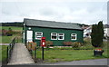
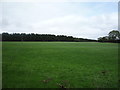
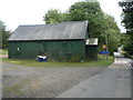
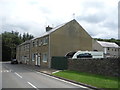
Photos of Hedleyhope

Area Information
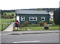
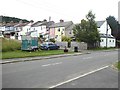
Living in Hedleyhope offers a distinct experience within Northumberland, characterised by its rural setting and lack of urban density. You will find this civil parish spans 6.5 km², providing a compact yet spacious environment for residents. The area does not face the planning constraints often associated with larger development zones, such as designated Areas of Outstanding Natural Beauty or Ramsar wetland sites. This status suggests a locality focused on preservation and quiet living rather than rapid expansion. While specific boundary descriptions are not provided in current records, the parish structure implies a close-knit community layout typical of smaller English settlements. Residents here navigate a landscape defined by localised amenities and a slower pace, away from the congestion of major cities. The absence of protected woodlands within your immediate vicinity, though a minor ecological note, distinguishes the land use from areas with stricter green belt restrictions. For those seeking homes in Hedleyhope, the environment prioritises stability. Daily life likely involves reliance on local services and perhaps some travel for broader amenities. The area's small scale means neighbours may know one another well, creating a sense of familiarity. Your experience of living in this parish will centre on the balance between isolation and community connection. The physical footprint remains modest, ensuring that the character of the area does not get lost in larger municipal sprawl. You gain a clear picture of what defines this specific civil parish without the typical pressures of population growth.
- Area Type
- Parish
- Area Size
- 6.5 km²
- Population
- Not available
- Population Density
- Not available
Demographics
The community in Hedleyhope presents a specific demographic profile that defines daily life here. You will find that 68% of households are owner-occupied, indicating a settled, long-term resident base. This high ownership rate often correlates with stability and a lower turnover of families compared to renting areas. Age analysis reveals a significant tilt towards older demographics, with a median age of 70 years. This figure suggests the area appeals strongly to retirees or individuals approaching retirement. The most common age range data is listed as total, reflecting the broad distribution of residents across the parish. Household composition follows this trend, with fewer young families and dependents likely predominating the domestic scene. Diversity metrics are not explicitly detailed beyond the general population structure, so you should expect a community that largely mirrors the wider rural north of England. Religious affiliations and predominant ethnic groups remain part of the broader census picture specific to this parish. From a quality of life perspective, the older population may foster a quieter evening atmosphere and different local needs. Your understanding of this community requires acknowledging the shift away from a young workforce. This demographic makeup influences everything from local shop hours to community club memberships. When considering homes in Hedleyhope, recognise that you are joining a population with established roots and specific lifestyle requirements.
Household Size
Accommodation Type
Tenure
Ethnic Group
Religion
Household Composition
Age
Household Deprivation
NS-SEC
Explore more demographic insights in this area
Go to Demographics tabPlanning
Planning Constraints
- Flood RiskPremium
- Ramsar Wetland SitesPremium
- Area of Outstanding Natural BeautyPremium
- Protected Nature ReservePremium
- Protected WoodlandPremium
- Crime RiskPremium