Area Overview for Hebburn South Ward
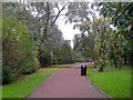
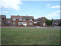
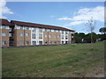
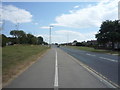
Photos of Hebburn South Ward


Area Information
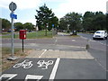
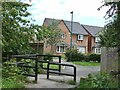
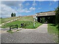
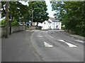
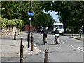
Hebburn South Ward is a compact district within the South Tyneside borough, covering an area of just 2.8 square kilometres. Despite its small footprint, the ward supports a population of 1,552 residents, resulting in a density of 562 people per square kilometre. This ward is part of the broader town of Hebburn, which sits on the south bank of the River Tyne between Gateshead and Jarrow. The area may have as few as 18 wards across the entire South Tyneside borough, but Hebburn South serves as a distinct residential zone for local families and long-term residents. Its history runs deep, with Saxon roots dating back to the 8th century as a fishing hamlet. The landscape still echoes this past, featuring a partially visible defensive wall at St John's Church that dates from the Middle Ages. Today, life here centres on the local community rather than major commercial hubs, offering a quieter pace for those seeking a ward with significant historical character on the North East coast. You find yourself living in a neighbourhood where the past and present meet directly on the banks of the River Tyne.
- Area Type
- District Borough Unitary Ward
- Area Size
- 2.8 km²
- Population
- 1552
- Population Density
- 562 people/km²
Demographics
The community in Hebburn South Ward has a notably older profile compared to many other areas. The median age is 70, indicating that the population is dominated by senior residents. This age distribution aligns with a high level of home ownership, standing at 61 per cent of the total population. This figure suggests that many families moved here decades ago and have remained over time, building long-term roots in the ward. While specific data on household composition, accommodation types, predominant ethnic groups, and religion is not detailed in the current records, the high ownership rate and older median age create a specific social fabric. Living in Hebburn South Ward often means engaging with a community where established residents form the majority. The area attracts those who value stability and proximity to local amenities rather than the transient nature found in student or young professional hubs. Your daily interactions here likely reflect a mature demographic focused on local services and community stability rather than rapid population turnover.
Household Size
Accommodation Type
Tenure
Ethnic Group
Religion
Household Composition
Age
Household Deprivation
NS-SEC
Explore more demographic insights in this area
Go to Demographics tabPlanning
Planning Constraints
- Flood RiskPremium
- Ramsar Wetland SitesPremium
- Area of Outstanding Natural BeautyPremium
- Protected Nature ReservePremium
- Protected WoodlandPremium
- Crime RiskPremium