Area Overview for Healeyfield
Photos of Healeyfield
Area Information
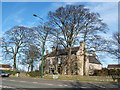
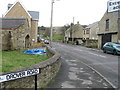
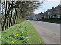
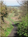
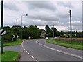
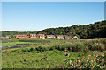
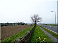
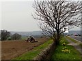
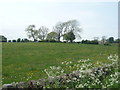
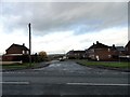
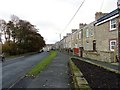
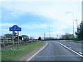
Healeyfield is a civil parish situated in County Durham, England, located south-west of Consett. The area covers a total of 13.0 km² and sits at coordinates 54°49′43″N 1°53′35″W. At the time of the 2011 census, the civil parish recorded a population of 1,544 residents. The largest settlement within this parish is the village of Castleside, which forms a key part of the local identity. You will find the name derived from Old English roots, likely meaning "the high clearing". This historical context shapes the landscape you see today. Living in Healeyfield means engaging with a location defined by its deep industrial past. The area contains numerous listed buildings and scheduled monuments, including the Howns Gill Viaduct, a Grade II* structure built in 1858. You can also walk across Healeyfield Bridge, constructed around 1832, which spans a former railway line. The parish is steeped in history, having first appeared in the Boldon Book as "Heleie". Medieval development occurred under Bishop Hugh du Puiset, extending his demesne into the Derwent valley. A medieval chapel exists in the local history, first mentioned in 1228 and again in 1291. This narrative of the area is completed by its industrial heritage. Three lead mines operated here until disuse in the 1920s. A smelting mill at nearby Watergate, Castleside, functioned from 1805 until the same decade. During the First World War, the site hosted a prisoner of war camp established in August 1916. Today, evidence of this legacy remains in the form of milestones, boundary stones dated c.1823, and the remains of a Roman aqueduct. Homes in Healeyfield offer a connection to a distinguished and tangible heritage.
- Area Type
- Parish
- Area Size
- 13.0 km²
- Population
- Not available
- Population Density
- Not available
Demographics
The community profile of Healeyfield reflects an area with a mature population. The median age for residents stands at 70 years. This demographic concentration indicates that the area attracts a significant number of older adults seeking a quieter lifestyle. You are looking at a neighbourhood where the traditional age structure often differs from urban commuting corridors. Home ownership is the dominant housing tenure in the parish. Records show that 83% of local households own their homes outright or with a mortgage. This high level of ownership typically results in greater community stability and investment in local properties. The remaining 17% consist primarily of landlords renting to tenants, creating a balanced but predominantly owner-occupied environment. There is no indication of excessive transient populations moving through the area frequently. Household composition in Healeyfield aligns with the age profile, though specific breakdowns into family units versus single-person households are not detailed in current records. Approval figures suggest a community that has grown accustomed to slower-paced living. The area maintains a population of 1,544 as recorded in the 2011 census. While specific data on predominant ethnic groups or religious affiliations is not included in the current dataset, the historical record of the area shows it was a Centre for Chilton family manors for 200 years. The high home ownership rate of 83% suggests a strong attachment to the local geography and a desire for long-term residence rather than short-term rental cycles.
Household Size
Accommodation Type
Tenure
Ethnic Group
Religion
Household Composition
Age
Household Deprivation
NS-SEC
Explore more demographic insights in this area
Go to Demographics tabPlanning
Planning Constraints
- Flood RiskLocked
- Ramsar Wetland SitesLocked
- Area of Outstanding Natural BeautyLocked
- Protected Nature ReserveLocked
- Protected WoodlandLocked
- Crime RiskLocked