Area Overview for Headland & Harbour Ward
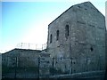
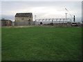
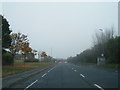
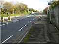
Photos of Headland & Harbour Ward


Area Information
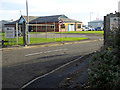
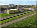
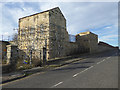
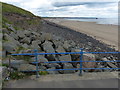
Headland & Harbour Ward sits within Hartlepool Borough Council in North East England. This district covers 5.5 km² and forms the site of the original Hartlepool. For centuries, this location served as the natural harbour for the old fishing town. Today, the ward encompasses the Headland area, which remains a recognised conservation zone. The geography defines the daily rhythm for the 1,736 residents who call this small borough unitary chapter home. Living in Headland & Harbour Ward means residing in a compact historical environment with a clear maritime identity. The ward occupies a specific coordinate position at approximately 54.699787444900984, -1.203129841241242. This restricted land size creates a close-knit setting where the history of the fishing industry continues to shape the local landscape. You will find that the area retains its heritage character while functioning as a modern residential district. The distinction of being the original settlement site adds weight to any decision regarding homes in Headland & Harbour Ward.
- Area Type
- District Borough Unitary Ward
- Area Size
- 5.5 km²
- Population
- 1736
- Population Density
- 318 people/km²
Demographics
The community within Headland & Harbour Ward presents an older demographic profile. The median age for residents is 70 years old, indicating a significant population shift towards retirement living. When exploring schools near Headland & Harbour Ward, buyers should note that the age profile suggests a lower demand for primary education facilities within the immediate ward boundaries. Households in this area show a home ownership rate of 36 per cent. This figure implies that a majority of residents rent or access housing through other means rather than owning their property outright. The ward represents a distinct market segment compared to younger family-centric areas. With a total population of 1,736 people spread across 5.5 km², the density reaches 318 people per square kilometre. This concentration supports social interaction while maintaining the quiet atmosphere typical of a heritage conservation area. The age data indicates that you are likely to encounter a neighbourhood favouring tranquility and convenience over night-time entertainment.
Household Size
Accommodation Type
Tenure
Ethnic Group
Religion
Household Composition
Age
Household Deprivation
NS-SEC
Explore more demographic insights in this area
Go to Demographics tabPlanning
Planning Constraints
- Flood RiskPremium
- Ramsar Wetland SitesPremium
- Area of Outstanding Natural BeautyPremium
- Protected Nature ReservePremium
- Protected WoodlandPremium