Area Overview for Headland
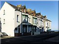
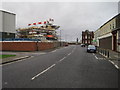
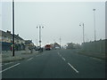
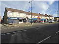
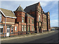
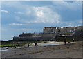
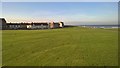
Photos of Headland


Area Information
Living in Headland offers a defined experience within a compact civil parish covering just 1.4 km². This specific size creates a contained environment where daily needs are often within close reach, distinguishing it from larger, more sprawling towns. The area functions as a distinct entity in the wider region, providing a clear boundary for those seeking a specific type of locale. You occupy a space that is substantial enough to offer variety yet small enough to maintain a sense of enclosure. The character of Headland is shaped entirely by the people and the physical structures within these precise limits. There is no ambiguity about the scale of your surroundings; the entire community exists within this fixed footprint. Prospective homeowners must understand that choosing a home here means selecting a property within a very specific and bounded geographical area. The identity of Headland is clear and singular, devoid of the sprawling infrastructure found in larger settlements. You are choosing a precise location defined by its registered civil parish status and its limited land mass.
- Area Type
- Parish
- Area Size
- 1.4 km²
- Population
- Not available
- Population Density
- Not available
Demographics
The community in Headland reflects a mature population, with a median age of 70. This statistic highlights that the majority of residents are older adults. The most common age range encompasses the broad category of age totals, indicating a lack of younger demographic spikes. Home ownership stands at 48%, signifying that nearly half of the households own their properties outright or through a mortgage, while the other half likely reside in rented accommodation. This split suggests a balanced but significant presence of tenanted homes alongside owner-occupied dwellings. The data does not specify dominant household compositions, ethnic groups, or religious affiliations, precluding analysis of diversity metrics. Deprivation levels are not included in the available figures, so any assessment of economic standing remains unsubstantiated by provided statistics. You can observe an older, settled population where around half of the families hold tenure rights in this civil parish. The absence of specific diversity or deprivation data means the profile relies heavily on the age structure and ownership split.
Household Size
Accommodation Type
Tenure
Ethnic Group
Religion
Household Composition
Age
Household Deprivation
NS-SEC
Explore more demographic insights in this area
Go to Demographics tabPlanning
Planning Constraints
- Flood RiskPremium
- Ramsar Wetland SitesPremium
- Area of Outstanding Natural BeautyPremium
- Protected Nature ReservePremium
- Protected WoodlandPremium