Area Overview for Haughton & Springfield Ward
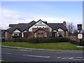
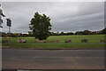
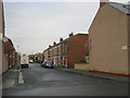
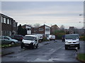
Photos of Haughton & Springfield Ward


Area Information
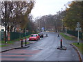
Living in Haughton & Springfield Ward offers a distinctly mature residential experience within a compact footprint. This district borough unitary ward covers just 1.6 km², creating a tight-knit environment where distances are short and accessibility is high. You will find that daily life here centres around established routines rather than rapid urban growth. The area functioned as a relatively isolated community historically, which has shaped a quiet, domestic atmosphere for many decades. Prospective buyers should note that this is not an area known for rapid expansion or large-scale new developments. Instead, the character of Haughton & Springfield Ward remains defined by its long-standing residents and stable housing stock. The ward presents a clear demographic picture that influences the local rhythm. With a median age of 70, the community is significantly older than the national average. This demographic profile means you are entering an area favoured by retirees and long-term households. The Population density is concentrated within a very small geographic boundary, suggesting a finished and settled landscape. You will likely encounter a neighbourhood where the pace of life is slower, and where community interactions often revolve around shared familiarity rather than transient movement. This specific combination of small area size and an older population creates a unique living dynamic focused on stability and established local services rather than trendy, youthful vibrancy.
- Area Type
- District Borough Unitary Ward
- Area Size
- 1.6 km²
- Population
- Not available
- Population Density
- Not available
Demographics
The community profile of Haughton & Springfield Ward is defined by a significantly older population compared to the rest of the UK. The median age in the ward is 70, meaning that half the residents are older than this age and half are younger. This represents a shift away from a typical younger, family-centric demographic found in many other parts of Hull. You can expect a neighbourhood where many households have remained in their homes for decades, leading to high levels of continuity within the streets. Home ownership stands at 62% in Haughton & Springfield Ward, indicating that the majority of residents have purchased their properties outright or through mortgages rather than renting. This high level of tenure reflects the area's status as a settled residential zone where families and individuals have taken a long-term commitment to specific addresses. The household composition data shows that the ward caters to various living arrangements, though the dominant theme is stability rather than temporary tenancy. There is no single predominant ethnic group or specific religious affiliation highlighted in the available statistics for this ward, so the community reflects the broader, diverse population of South Yorkshire without one group defining the entire census profile. This demographic reality means that services and local amenities cater primarily to the needs of an older cohort, from health tourism to leisure activities suited to retirees.
Household Size
Accommodation Type
Tenure
Ethnic Group
Religion
Household Composition
Age
Household Deprivation
NS-SEC
Explore more demographic insights in this area
Go to Demographics tabPlanning
Planning Constraints
- Flood RiskPremium
- Ramsar Wetland SitesPremium
- Area of Outstanding Natural BeautyPremium
- Protected Nature ReservePremium
- Protected WoodlandPremium