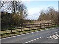
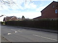
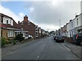
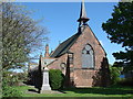
Area Overview for Haswell
Photos of Haswell


Area Information
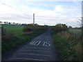
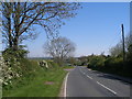
Living in Haswell offers a compact, established environment within a 38.2-hectare built-up area. The community is characterised by a median age of 70, suggesting a population skewed towards older residents. This demographic profile shapes daily life, with a focus on stability and proximity to essential services. The area’s small size means amenities are within practical reach, including two rail stations—Horden Peterlee and Seaham Railway Station—linking residents to nearby towns. Retail options are limited but functional, with five shops including Spar and Co-op Shotton. While broadband connectivity is poor (score 30), mobile coverage is strong (82), which may influence remote work feasibility. Haswell’s charm lies in its simplicity, though its older demographic and modest infrastructure may appeal to those prioritising quiet, low-maintenance living over modern conveniences.
- Area Type
- Built Up Area 250
- Area Size
- 38.2 hectares
- Population
- Not available
- Population Density
- Not available
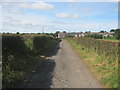
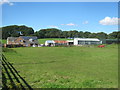
Residents of Haswell have access to five retail outlets, including Spar and Co-op Shotton, providing basic shopping needs within walking or short driving distance. The rail stations—Horden Peterlee and Seaham—offer links to nearby towns, enhancing access to broader amenities. While the area lacks detailed information on parks or leisure facilities, the presence of retail and rail options suggests a lifestyle focused on practicality. The compact nature of Haswell means daily errands are manageable without long commutes. The limited retail and leisure options may appeal to those seeking a quiet, low-stimulus environment but could be a drawback for others. Overall, the lifestyle here balances simplicity with essential connectivity.
Amenities
Schools
The nearest school to Haswell is Haswell Primary School, a primary education institution serving local children. No Ofsted ratings or academic performance data are provided, so evaluating the school’s quality must rely on other factors. The presence of a primary school suggests the area caters to families with younger children, though the absence of secondary schools or additional educational institutions is notable. For families requiring a full range of schooling, proximity to nearby towns via rail—such as Horden Peterlee or Seaham stations—may be necessary. The single school listed implies limited educational options within Haswell itself, which could influence decisions for homebuyers prioritising comprehensive schooling.
| Rank | School | Type | Entry gender | Ages |
|---|
Explore more schools in this area
Go to Schools tabDemographics
Haswell’s population has a median age of 70, the highest in the dataset, indicating a community predominantly composed of older individuals. Home ownership stands at 61%, suggesting a balance between owner-occupied properties and rental stock. The data provides no specific figures on household composition, accommodation types, or ethnic diversity, so these aspects remain unquantified. The lack of detailed demographic breakdowns means assumptions about family structures or cultural diversity cannot be made. For quality of life, the older population may imply a slower pace of life but could also signal a need for age-friendly infrastructure. The absence of deprivation data prevents further analysis of socioeconomic conditions, though the 61% home ownership rate suggests a stable, if not affluent, community.
Household Size
Accommodation Type
Tenure
Ethnic Group
Religion
Household Composition
Age
Household Deprivation
NS-SEC
Explore more demographic insights in this area
Go to Demographics tabPlanning
Planning Constraints
- Crime RiskPremium