Area Overview for Hartlepool
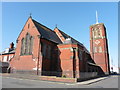
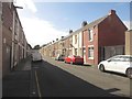
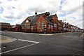
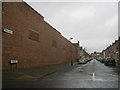
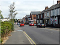
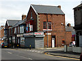
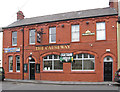
Photos of Hartlepool


Area Information
Living in Hartlepool offers a grounded experience within a compact local authority district covering just 27.5 square kilometres. You will find a population of 25,124 residents spread relatively evenly across this space, resulting in a population density of 914 people per square kilometre. This density creates neighbourhoods that are close-knit without the overwhelming pressure of major metropolitan centres. The area functions as a self-contained borough where daily life revolves around local amenities and community hubs rather than vast distances. There is a clear sense of place defined by its manageable size and established residential character. Prospective buyers entering the market here encounter a community with deep roots and a specific rhythm to its daily operation. The compact nature of the borough means that essential services and local infrastructure are generally within easy reach. You do not need to travel far to access the facilities required for a typical weekly routine. The environment supports a lifestyle where convenience is inherent to the layout of the district. Understanding this scale is vital for anyone weighing the decision to purchase property in Hartlepool against larger or more sprawling regions. ### The community profile of Hartlepool presents a distinct age structure dominated by older residents. The median age stands at 70 years, which places this area significantly above the national average for younger families. Most people in the borough fall into the broader age total category, indicating that the population is not skewed towards teenagers or young workers. You will encounter a high level of home ownership, with 59% of households owning their properties outright or with a mortgage. This statistic suggests a stable community where long-term residents have taken root in the local housing market for extended periods. Accommodation types reflect the settled nature of the borough, supporting a broad range of needs appropriate for an ageing population. While specific breakdowns of household composition and predominant ethnic groups are aggregated under total figures in available records, the high ownership rate points to a low rental turnover. This stability often correlates with stronger community bonds but may mean fewer young professional moves in and out annually. The demographic make-up indicates a locality where the primary demand comes from those seeking security and comfort in their later years rather than student housing or young family expansion units. ### The housing landscape in Hartlepool is heavily weighted towards ownership, with 59% of residents owning their homes. This figure distinguishes the area as an owner-occupied community rather than a market driven by private landlords or housing associations. When you look for homes in Hartlepool, you are entering a sector where permanence is the primary characteristic of the stock. The remaining 41% of households are renter-occupied, which provides a secondary but smaller segment of the market. Accommodation types in the district align with the needs of the prevailing age profile, prioritising accessibility and quiet over high-density urban living. You will find that the housing supply caters primarily to established residents who have stayed through various economic cycles. This market condition means that buying in Hartlepool often involves purchasing from previous owners who have refined the properties over decades. The high ownership percentage reduces the volatility typical of areas with high rental turnover. Consequently, the estate market operates with predictable seasonal swings rather than the rapid transaction speeds seen in cities. Your search for a property here should focus on finding a home that suits your long-term lifestyle within this stable framework of local housing. ### Digital infrastructure in Hartlepool supports modern remote work and daily connectivity with impressive reliability. Fixed broadband quality scores an excellent 99 out of 100, ensuring that you experience seamless speeds for streaming, video conferencing, and large file transfers. This rating places the area among the top performers for internet reliability in the region. Mobile network coverage receives a strong 85 out of 100, indicating robust signal strength throughout most of the borough for typical device usage. Residents relying on smartphones for banking, navigation, and communication will find consistent service without frequent dropouts. Working from home in Hartlepool is feasible for the majority of digital professionals due to these high connectivity standards. The combination of near-perfect fixed line and strong mobile data means that location within the borough rarely compromises your ability to stay connected. Neither broadband nor mobile scores suggest any significant digital black spots that would hinder a home-based business or heavy internet user. You can plan your renovation or layout based on the assumption that high-speed connectivity will be maintained across your property. These statistics confirm that living in Hartlepool provides a digital environment equal to urban centres. ### Safety considerations for Hartlepool require a realistic assessment of the local environment. The crime risk level is rated as WARNING, reflecting a calculated score of 48 out of 100, where lower scores indicate less risk. This places the area in a medium crime risk category relative to other locations. You should expect crime rates to be around average compared to national figures, meaning no extreme danger exists but standard precautions remain essential. A safety score of 48 means that while you can walk the neighbourhoods generally, vigilance is necessary. Practical steps include securing doors and windows properly and being aware of your surroundings, particularly in the evenings. The environment does not necessitate heightened fears found in high-risk zones, yet it also does not offer the complete immunity found in low-risk areas. Residents should adopt standard security habits rather than assuming total safety or embracing carelessness. This balanced risk profile is typical for many established districts where the vast majority of households are secure, but opportunistic incidents can still occur. When evaluating homes in Hartlepool, consider installing a secure entry system as a prudent measure. The overall feeling depends on your personal tolerance for medium-level crime risks. ### What is the typical age of people living in Hartlepool?The median age in Hartlepool is 70 years. This indicates that the community is predominantly made up of older residents. Most people in the area fall into the total age category, meaning there are fewer young families compared to national averages. This demographic profile directly influences the types of homes available and the pace of life. How reliable is the internet for working from home in Hartlepool?Digital connectivity in Hartlepool is excellent. Fixed broadband scores 99 out of 100, offering top-tier speeds for remote work and streaming. Mobile coverage also scores 85 out of 100, ensuring strong signal strength. These figures confirm that residents can rely on stable connections for digital tasks without significant interruption. Is Hartlepool a safe place to raise a family?The area carries a medium crime risk with a safety score of 48 out of 100. Crime rates are around average, requiring standard security precautions and situational awareness. While there are no extreme risks, you should adopt normal vigilance habits regarding home security and personal safety during daily activities. What does the housing market in Hartlepool look like?Home ownership reaches 59% in Hartlepool, making it a stable, owner-occupied market. You will find fewer renters than in cities, suggesting a community built on long-term residency. The housing stock reflects the older population, with properties suited to established residents rather than high-turnover rental demands.
- Area Type
- District/Borough
- Area Size
- 27.5 km²
- Population
- 25124
- Population Density
- 914 people/km²
Demographics
The community profile of Hartlepool presents a distinct age structure dominated by older residents. The median age stands at 70 years, which places this area significantly above the national average for younger families. Most people in the borough fall into the broader age total category, indicating that the population is not skewed towards teenagers or young workers. You will encounter a high level of home ownership, with 59% of households owning their properties outright or with a mortgage. This statistic suggests a stable community where long-term residents have taken root in the local housing market for extended periods. Accommodation types reflect the settled nature of the borough, supporting a broad range of needs appropriate for an ageing population. While specific breakdowns of household composition and predominant ethnic groups are aggregated under total figures in available records, the high ownership rate points to a low rental turnover. This stability often correlates with stronger community bonds but may mean fewer young professional moves in and out annually. The demographic make-up indicates a locality where the primary demand comes from those seeking security and comfort in their later years rather than student housing or young family expansion units. ### The housing landscape in Hartlepool is heavily weighted towards ownership, with 59% of residents owning their homes. This figure distinguishes the area as an owner-occupied community rather than a market driven by private landlords or housing associations. When you look for homes in Hartlepool, you are entering a sector where permanence is the primary characteristic of the stock. The remaining 41% of households are renter-occupied, which provides a secondary but smaller segment of the market. Accommodation types in the district align with the needs of the prevailing age profile, prioritising accessibility and quiet over high-density urban living. You will find that the housing supply caters primarily to established residents who have stayed through various economic cycles. This market condition means that buying in Hartlepool often involves purchasing from previous owners who have refined the properties over decades. The high ownership percentage reduces the volatility typical of areas with high rental turnover. Consequently, the estate market operates with predictable seasonal swings rather than the rapid transaction speeds seen in cities. Your search for a property here should focus on finding a home that suits your long-term lifestyle within this stable framework of local housing. ### Digital infrastructure in Hartlepool supports modern remote work and daily connectivity with impressive reliability. Fixed broadband quality scores an excellent 99 out of 100, ensuring that you experience seamless speeds for streaming, video conferencing, and large file transfers. This rating places the area among the top performers for internet reliability in the region. Mobile network coverage receives a strong 85 out of 100, indicating robust signal strength throughout most of the borough for typical device usage. Residents relying on smartphones for banking, navigation, and communication will find consistent service without frequent dropouts. Working from home in Hartlepool is feasible for the majority of digital professionals due to these high connectivity standards. The combination of near-perfect fixed line and strong mobile data means that location within the borough rarely compromises your ability to stay connected. Neither broadband nor mobile scores suggest any significant digital black spots that would hinder a home-based business or heavy internet user. You can plan your renovation or layout based on the assumption that high-speed connectivity will be maintained across your property. These statistics confirm that living in Hartlepool provides a digital environment equal to urban centres. ### Safety considerations for Hartlepool require a realistic assessment of the local environment. The crime risk level is rated as WARNING, reflecting a calculated score of 48 out of 100, where lower scores indicate less risk. This places the area in a medium crime risk category relative to other locations. You should expect crime rates to be around average compared to national figures, meaning no extreme danger exists but standard precautions remain essential. A safety score of 48 means that while you can walk the neighbourhoods generally, vigilance is necessary. Practical steps include securing doors and windows properly and being aware of your surroundings, particularly in the evenings. The environment does not necessitate heightened fears found in high-risk zones, yet it also does not offer the complete immunity found in low-risk areas. Residents should adopt standard security habits rather than assuming total safety or embracing carelessness. This balanced risk profile is typical for many established districts where the vast majority of households are secure, but opportunistic incidents can still occur. When evaluating homes in Hartlepool, consider installing a secure entry system as a prudent measure. The overall feeling depends on your personal tolerance for medium-level crime risks. ### What is the typical age of people living in Hartlepool?The median age in Hartlepool is 70 years. This indicates that the community is predominantly made up of older residents. Most people in the area fall into the total age category, meaning there are fewer young families compared to national averages. This demographic profile directly influences the types of homes available and the pace of life. How reliable is the internet for working from home in Hartlepool?Digital connectivity in Hartlepool is excellent. Fixed broadband scores 99 out of 100, offering top-tier speeds for remote work and streaming. Mobile coverage also scores 85 out of 100, ensuring strong signal strength. These figures confirm that residents can rely on stable connections for digital tasks without significant interruption. Is Hartlepool a safe place to raise a family?The area carries a medium crime risk with a safety score of 48 out of 100. Crime rates are around average, requiring standard security precautions and situational awareness. While there are no extreme risks, you should adopt normal vigilance habits regarding home security and personal safety during daily activities. What does the housing market in Hartlepool look like?Home ownership reaches 59% in Hartlepool, making it a stable, owner-occupied market. You will find fewer renters than in cities, suggesting a community built on long-term residency. The housing stock reflects the older population, with properties suited to established residents rather than high-turnover rental demands.
Household Size
Accommodation Type
Tenure
Ethnic Group
Religion
Household Composition
Age
Household Deprivation
NS-SEC
Explore more demographic insights in this area
Go to Demographics tabPlanning
Planning Constraints
- Crime RiskPremium