Area Overview for Harrowgate Hill Ward
Photos of Harrowgate Hill Ward


Area Information
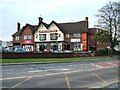
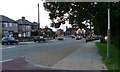
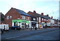
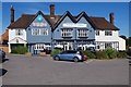
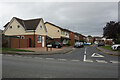
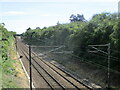
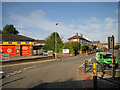
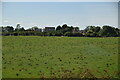
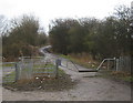
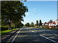
Harrowgate Hill Ward sits within the Borough of Darlington in County Durham, covering a footprint of 2.1 square kilometres. This ward comprises the distinct villages of Beaumont Hill, Harrowgate Village, and Ashbrook, alongside the larger settlement of Harrowgate Hill itself. Historically significant, the area became a separate civil parish in 1894 before merging with Darlington in 1907. The population in the 2011 census stood at 5,997, a figure that expanded to approximately 7,000 residents following boundary changes in 2015. You will find the community extends from Thompson Street to the north up to Beaumont Hill. The geography is defined by its proximity to major rail infrastructure, as the ward formerly lay on two sides of the East Coast Main Line and the Tees Valley Line. Buying a home here means living in a suburb that blends village character with urban connections. The mix of unparished land and Whessoe civil parish creates a varied landscape for those considering life in this part of North East England.
- Area Type
- District Borough Unitary Ward
- Area Size
- 2.1 km²
- Population
- Not available
- Population Density
- Not available
Demographics
The community profile reveals a demographic with a median age of 70 years, indicating a significant population of older residents. You are buying a neighbourhood where the household composition and ethnicity data reflect a mature settlement. Home ownership is the dominant tenure style, with 79 per cent of properties owner-occupied. This means the social fabric is largely built around families and individuals who have stayed long-term or purchased locally. The remaining 21 per cent live in rented accommodation, suggesting a smaller market for private landlords to target. There are specific villages included in this ward, such as Harrowgate Hill, which form the core of the district. The total population figures from previous censuses show a stable growth trajectory from 2011 to 2015. When you think about the reputation of Harrowgate Hill Ward, these demographics paint a picture of stability. Specific data on religion and predominant ethnic groups is recorded in the ward profile, though the overwhelming statistic remains the high proportion of owner-occupiers.
Household Size
Accommodation Type
Tenure
Ethnic Group
Religion
Household Composition
Age
Household Deprivation
NS-SEC
Explore more demographic insights in this area
Go to Demographics tabPlanning
Planning Constraints
- Flood RiskPremium
- Ramsar Wetland SitesPremium
- Area of Outstanding Natural BeautyPremium
- Protected Nature ReservePremium
- Protected WoodlandPremium