Area Overview for Hardwick & Salters Lane Ward
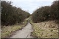
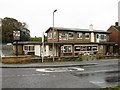
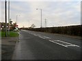
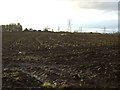
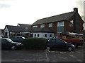
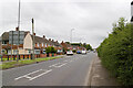
Photos of Hardwick & Salters Lane Ward


Area Information
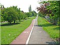
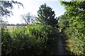
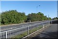
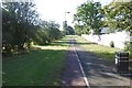
Hardwick & Salters Lane Ward is a small electoral ward located within the unitary authority of Stockton-on-Tees in the North East of England. This compact district covers just 2.0 km² while hosting a population of 4,021 residents. Living in Hardwick & Salters Lane Ward means sharing space in a densely populated environment with a density of 1,963 people per square kilometre. The ward coordinates sit at 54.5857918923651, -1.3541329729534684, placing it firmly within the Stockton-on-Tees geographical area. Your daily life here involves navigating a community where households are relatively close together compared to surrounding regions. The majority of homes in Hardwick & Salters Lane Ward cluster around specific postcodes associated with the statutory ward. This area is part of the broader North East region but operates as a distinct unitary local government area. You will find transport links and local services accessible within this المحدودة footprint. The ward boundaries are defined by official maps from the Boundary Commission for England. It is a place where proximity defines your experience, blending residential living with the urban character of Stockton-on-Tees.
- Area Type
- District Borough Unitary Ward
- Area Size
- 2.0 km²
- Population
- 4021
- Population Density
- 1963 people/km²
Demographics
The community profile in Hardwick & Salters Lane Ward skews significantly towards older residents. The median age stands at 70 years, indicating a population where elderly individuals form the central demographic. Age data identifies 'Age: Total' as the most common age range category in the records. Consequently, neighbourhood dynamics likely centre on an older cohort rather than young families or students. Homeownership affects only 44% of residents in this ward, meaning roughly one in two households rents their accommodation. This suggests a mixed tenancy market where secure and assured shorthold tenancies probably coexist with owner-occupied properties. The remainder of households operate under social housing arrangements or private rental agreements typical of county boroughs. Accommodation data does not specify detailed breakdowns between terraced, semi-detached, or detached housing types. Ethical diversity and religious composition are marked as total aggregates without specific breakdown percentages available for analysis. However, the high median age suggests you are buying into a settled community rather than a rapidly shifting population. When considering demographics, note that 56% of residents do not own their homes, highlighting the prevalence of renting in Hardwick & Salters Lane Ward.
Household Size
Accommodation Type
Tenure
Ethnic Group
Religion
Household Composition
Age
Household Deprivation
NS-SEC
Explore more demographic insights in this area
Go to Demographics tabPlanning
Planning Constraints
- Flood RiskPremium
- Ramsar Wetland SitesPremium
- Area of Outstanding Natural BeautyPremium
- Protected Nature ReservePremium
- Protected WoodlandPremium