Area Overview for Grindon and Thorpe Thewles
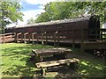
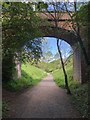
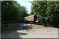
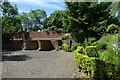
Photos of Grindon and Thorpe Thewles
Area Information
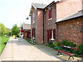
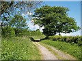
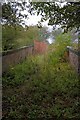
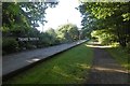
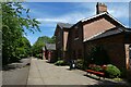
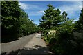
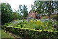
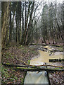
Grindon and Thorpe Thewles stands as a distinct civil parish within England, encompassing an area of 11.1 km². This modest size defines the scale of daily life for residents who call this location home. You are looking at a settled community where the physical boundaries are clear and manageable. Living in Grindon and Thorpe Thewles involves navigating a specific rural landscape that avoids major planning constraints such as Ramsar wetland sites or Areas of Outstanding Natural Beauty. The parish does host a small pocket of protected woodland, which accounts for a score of 1.87 on the risk scale, indicating a low level of planning constraints in that specific regard. Your experience here will be shaped by a deep sense of established local roots. The absence of significant flood risk, with a safety score reflecting very low coverage probability, provides peace of mind regarding natural hazards. However, the low broadband quality score of 24 out of 100 presents a tangible limitation for high-speed digital needs. Daily life balances a peaceful rural setting with a relaxation on connectivity speeds. If you value a quiet environment away from the pressure of extensive transport networks, Grindon and Thorpe Thewles offers a defined slice of the countryside. The area represents a choice for those who prioritise spatial compactness and established safety profiles over cutting-edge digital infrastructure.
- Area Type
- Parish
- Area Size
- 11.1 km²
- Population
- Not available
- Population Density
- Not available
Demographics
The community within Grindon and Thorpe Thewles is defined by a very mature population. You will find that the median age of residents is 70 years old, making this one of the oldest areas in the region. Most common age groups skew heavily towards this senior demographic, reflecting a neighbourhood where life changes are often slower-paced. Home ownership stands at 89 per cent, creating an area where long-term residents typically hold their titles rather than renting. This high rate of ownership suggests a population deeply invested in the locality. Household composition and accommodation types follow the pattern of a settled, older community. You can expect a finding of stability rather than a high turnover of new arrivals. The population exhibits a homogenous character, with ethnicity and religious data showing total counts that align with a traditional English village profile. Deprivation levels are a secondary concern compared to the demographic reality of an elderly population. This age profile means social services and local shops will cater to specific needs of seniors. Living in Grindon and Thorpe Thewles means sharing your home with neighbours who likely have been there for decades. The community feel relies on these long-standing ties rather than a influx of newcomers.
Household Size
Accommodation Type
Tenure
Ethnic Group
Religion
Household Composition
Age
Household Deprivation
NS-SEC
Explore more demographic insights in this area
Go to Demographics tabPlanning
Planning Constraints
- Flood RiskPremium
- Ramsar Wetland SitesPremium
- Area of Outstanding Natural BeautyPremium
- Protected Nature ReservePremium
- Protected WoodlandPremium
- Crime RiskPremium