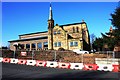
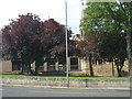
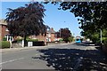
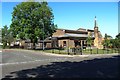
Area Overview for Grangefield Ward
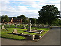
Photos of Grangefield Ward

Area Information
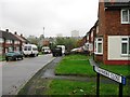
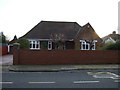
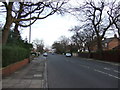
Grangefield Ward is a small district within the borough of second layer unitary authority that covers exactly one square kilometre. Despite its modest footprint, it hosts a tightly knit community of over twenty thousand residents. The area possesses a distinct character shaped by its compact size and established residential nature. You will find that daily life here revolves around immediate access to local amenities and a quiet, settled pace. The ward functions as a self-contained neighbourhood where familiarity forms a core part of the experience. Prospective buyers looking at Grangefield Ward should note that its limited area size often correlates with high density in specific zones. This concentration makes essential services readily accessible without the need for extensive travel. The location appeals to those who prefer a defined neighbourhood boundary rather than sprawling suburban landscapes. Living in Grangefield Ward offers a sense of stability and permanence that larger districts sometimes lack. The enclosed nature of the ward creates a village-like atmosphere even within the broader urban context. Your view of life here will likely include interactions with long-term neighbours and consistent local rhythms. The geography supports a straightforward layout where destinations are neither hidden nor distant. This straightforwardness defines the practical reality of owning a home in this specific administrative unit.
- Area Type
- District Borough Unitary Ward
- Area Size
- 1.0 km²
- Population
- Not available
- Population Density
- Not available
Demographics
The population profile of Grangefield Ward is heavily weighted toward older residents, with a median age of seventy years. This demographic shift defines the social fabric of the ward and influences the types of services that cater to the community. The most common age bracket aligns with the total population, confirming that the majority of households include mature individuals or empty nesters. Consequently, you should expect a quieter domestic environment compared to areas dominated by families with young children. Housing data reveals that seventy-five percent of residents own their home outright or have a mortgage. This high rate of homeownership suggests a community invested in long-term stability within Grangefield Ward. The remaining twenty-five percent are likely tenants or dependents living in the household of an owner. You will encounter relatively low traffic congestion related to school runs or evening playdates. Similarly, household composition reflects the needs of an aging population, with fewer single-person households under working age. The ward represents a mature settlement where retirement living and downsizing are common transitions. Families living in Grangefield Ward often include grown children or elderly parents rather than school-age dependents. This demographic reality shapes the character of the streets and the scope of local demand.
Household Size
Accommodation Type
Tenure
Ethnic Group
Religion
Household Composition
Age
Household Deprivation
NS-SEC
Explore more demographic insights in this area
Go to Demographics tabPlanning
Planning Constraints
- Flood RiskPremium
- Ramsar Wetland SitesPremium
- Area of Outstanding Natural BeautyPremium
- Protected Nature ReservePremium
- Protected WoodlandPremium