Area Overview for Ferryhill
Photos of Ferryhill
Area Information
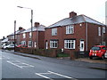
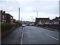
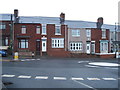
Ferryhill is a built-up area covering 2.2 square kilometres in County Durham. You are looking at a significant town within the wider regional landscape, defined by its substantial population size. This area serves as a practical residential location where daily life revolves around local infrastructure and community services. The character of living in Ferryhill is shaped by its established status as a town rather than a sprawling countryside settlement. Residents navigate a compact environment where services are concentrated within a manageable geographic footprint. This density allows for straightforward commutes to nearby urban centres while maintaining a distinct local identity. You will find that homes in Ferryhill cater to a specific demographic, creating a neighbourhood atmosphere that differs from pure rural living. The area functions efficiently as a self-contained community with essential amenities within practical reach of every address. Your daily routine will rely heavily on the established transport links and retail options that surround this 2.2 km² zone. The fact that Ferryhill operates as a recognised town means you can expect standard urban conveniences alongside the quiet of a smaller settlement. This balance makes it a viable option for those seeking a town-centre feel without the density of major cities. Understanding the scale of this built-up area is key to grasping what life is like here.
- Area Type
- Built Up Area 250
- Area Size
- 2.2 km²
- Population
- Not available
- Population Density
- Not available
Your daily life in Ferryhill revolves around five major retail outlets and four rail hubs situated within practical reach. You can visit Sainsburys Ferryhill for grocery shopping or head to the Co-op Ferryhill for convenience items. A Spar Chilton branch is also nearby, offering essential supplies and potential meal solutions for busy householders. These three supermarkets alone provide a comprehensive shopping experience without requiring a long journey into distant towns. Beyond shopping, your lifestyle is supported by excellent railway connectivity which touches on Newton Aycliffe, Shildon, and Bishop Auckland stations. There are four stations serving this locality, giving you multiple options for train travel. This accessibility means you can access cultural events, larger hospitals, or specialist retail outside Ferryhill with ease. The area offers a self-sufficient retail environment supplemented by regional transport links. You will find that the nearest amenities are positioned to serve the resident population efficiently. The presence of multiple supermarkets indicates a focus on daily convenience and family needs. While there are no mentioned leisure centres or parks in the immediate amenity list, the strong retail and transport infrastructure compensates well.
Amenities
Schools
Families in Ferryhill have access to three primary schools and one nursery within the immediate area. Ferryhill Station Primary School holds a Good Ofsted rating, offering a secure educational environment for younger children in close proximity. Dean Bank Primary and Nursery School carries a satisfactory rating, indicating it meets standards without the distinction of Excellence. You also have access to Cleves Cross Primary School, which operates in the primary sector but lacks a current Ofsted rating in the available records. For pre-school needs, Dean Road Nursery School provides care for the youngest residents. There is one other facility listed as The Woodlands which serves a general educational role outside the strict primary/nursery division. This mix of institutions means you do not have a single dominant school driving the local demographic. The presence of a Strongly rated primary option supports families who prioritise academic performance. However, the lack of secondary schools in the immediate vicinity means older children will need to travel for education. Living in Ferryhill requires planning if you have school-age children, as the nearest large comprehensive or high schools are likely further afield. The satellite schools serve the immediate neighbourhood effectively for early years and primary education.
| Rank | School | Type | Entry gender | Ages |
|---|
Explore more schools in this area
Go to Schools tabDemographics
The community profile of Ferryhill reveals an older population with a median age of 70 years. This statistic defines the social fabric of the area, indicating a residents' base that is significantly older than the national average. You will find that the largest group of residents falls into the broad 'Total' age category, reflecting the dominance of mature homeowners in this locale. Half of all residents in Ferryhill own their homes, a figure of exactly 50 per cent. This level of home ownership suggests a stable, long-term community where families have settled down rather than transient tenants moving through the area. The accommodation types and household compositions align with this older demographic, prioritising stability over high turnover. While specific ethnic and religious breakdowns are not detailed in the current records, the age profile remains the most prominent feature of living in Ferryhill. Your experience here will be coloured by an environment where retirement and established residency are the norms. There are fewer young families or university students compared to other areas across the country. This demographic reality impacts local services, business hours, and social activities available to you. You are purchasing a home in a neighbourhood where the primary demographic are established adults. The absence of younger cohorts also means less competition for local schools and different patterns for local governance priorities.