Area Overview for Fairfield Ward
Photos of Fairfield Ward

Area Information
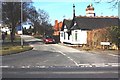
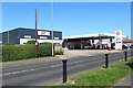
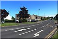
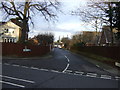
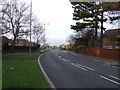
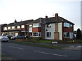
Fairfield Ward forms a distinct residential pocket within the northern suburbs of Stockton-on-Tees, situated in the Borough of Stockton-on-Tees, County Durham. This compact district covers exactly 2.4 square kilometres, offering a tightly knit community separated from neighbouring Hartburn by a green belt. The ward functioned as a self-contained suburban hub until the 2011 census recorded a population of 5,736 residents. Living in Fairfield Ward means navigating a defined boundary that ends abruptly at the town edge to the west. The location operates as a quiet residential zone, identifiable by its grid reference near 54.567°N and 1.355°W. Local life revolves around specific landmarks such as Green's Beck, Upsall Grove, and Lealholme Grove, which provide local character without urban intensity. Three public houses anchor the social scene: The Rimswell, The Fairfield, and The Mitre. Fairfield Library sits directly adjacent to Ian Ramsey CE Academy, suggesting a strong integration of community facilities with local education. This ward represents a settled, suburban environment where residents enjoy proximity to essential amenities while benefiting from clear separation from denser urban areas. The area maintains a clear identity as a dedicated residential suburb within the wider North East England landscape.
- Area Type
- District Borough Unitary Ward
- Area Size
- 2.4 km²
- Population
- Not available
- Population Density
- Not available
Demographics
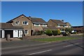
The community character in Fairfield Ward is defined by an exceptionally mature population profile. The median age for residents stands at 70 years, indicating a demographic skew heavily towards older adults. This age distribution suggests a neighbourhood where daily life moves at a slower, more settled pace. Home ownership is the dominant housing tenure model, with 81% of residents owning their properties outright or with a mortgage. This high level of equity implies long-term stability within the ward's social fabric. Household composition and accommodation type data indicate a community built for permanence rather than temporary stays. While specific figures for the most common age range and predominant ethnic group are not quantified in the available records, the overarching statistic points to a grey-haired resident base. Refugee, traveller, and homeless populations are not highlighted as specific demographic features in the current data. The social environment reflects a generation that has likely lived through significant changes in municipal structures, having resided in the ward as a distinct entity since at least 2011. For potential buyers, this suggests a market composed of people who have put down permanent roots rather than transient families. The 81% ownership rate further confirms that the majority of households here view their property as a fixed asset.
Household Size
Accommodation Type
Tenure
Ethnic Group
Religion
Household Composition
Age
Household Deprivation
NS-SEC
Explore more demographic insights in this area
Go to Demographics tabPlanning
Planning Constraints
- Flood RiskPremium
- Ramsar Wetland SitesPremium
- Area of Outstanding Natural BeautyPremium
- Protected Nature ReservePremium
- Protected WoodlandPremium