Area Overview for Esh
Photos of Esh
Area Information
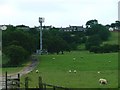
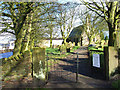
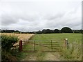
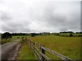
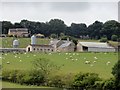
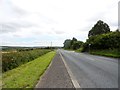
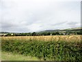
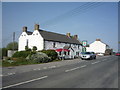
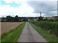
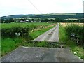
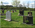
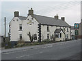
Living in Esh offers a distinctly rural experience within County Durham, North East England. This civil parish covers 13.1 km² and sits approximately 5 miles north-west of Durham city. You will find a population of around 1,380 residents spread across a landscape that blends working farms with former industrial heritage. The area originated as an ecclesiastical parish in 1733, evolving from chapelry sites that once encompassed settlements like Ushaw, Esh Winning and Langley Park. Today, the village centre features a stone cross from 1687 known as St Cuthbert's Cross, alongside two primary schools and two churches. The coal industry history is visible nearby, with Esh colliery reaching a peak of 870 workers in 1914, while Ushaw College, a Roman Catholic seminary founded in 1808, remains a prominent landmark in the vicinity. You can expect a quiet, close-knit atmosphere defined by local landmarks such as Esh Hall, which dates back to 1687, and the restored St Michael and All Angels Church built in 1770. Daily life here centres on these historic structures and the surrounding countryside rather than urban sprawl.
- Area Type
- Parish
- Area Size
- 13.1 km²
- Population
- 1380
- Population Density
- 105 people/km²
Demographics
The community in Esh is characterised by a significantly older population compared to the national average. The median age reaches 70 years, reflecting a demographic profile skewed heavily towards retirement-age residents. Most households are likely to be empty-nesters or retired couples rather than families with young children, although the area does maintain two primary schools to serve local needs. Home ownership stands at 59%, placing this area slightly above the national average for bike-ownership levels but indicating a substantial portion of the population owns their property outright. The remaining 41% of residents either rent or do not own their homes. You will find a distinct lack of data regarding specific ethnic group breakdowns, household composition details, and accommodation types beyond the totals, suggesting the village maintains a traditional, homogeneous character. The area does not report specific religious census data, though the presence of both a Church of England and Roman Catholic church indicates that religious facilities are available to residents. Life here appeals to those seeking stability rather than rapid demographic shifts or high youth population growth.
Household Size
Accommodation Type
Tenure
Ethnic Group
Religion
Household Composition
Age
Household Deprivation
NS-SEC
Explore more demographic insights in this area
Go to Demographics tabPlanning
Planning Constraints
- Flood RiskPremium
- Ramsar Wetland SitesPremium
- Area of Outstanding Natural BeautyPremium
- Protected Nature ReservePremium
- Protected WoodlandPremium
- Crime RiskPremium