Area Overview for Eglingham
Photos of Eglingham

Area Information
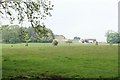
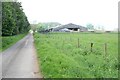
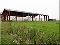
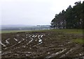
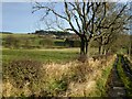
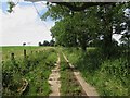
Living in Eglingham means settling into the boundaries of a civil parish that spans 45.2 square kilometres. You can describe this location as a rural settlement in Northumberland, England, where the wide expanse of land defines the character of daily life. The physical scale of the area supports a quieter existence away from the rush of major urban centres. A prospective buyer viewing homes in Eglingham will appreciate the open space surrounding the village core. This geographic context shapes everything from travel times to the available leisure opportunities. You will find that the.layout of the parish offers a distinct separation between residential zones and the wider countryside. This area does not carry the pressure of dense urban development. Instead, the living experience revolves around the natural constraints and freedoms of the Northumberland landscape. You are entering a community where the rhythm of life is dictated more by the seasons than by the hourly commute timetable. The sheer size of the parish ensures that development remains spread out, preventing the congestion often associated with larger towns. Anyone considering moving to Eglingham should note that this significant land area provides ample room for growth while maintaining the essential feel of a rural haven.
- Area Type
- Parish
- Area Size
- 45.2 km²
- Population
- Not available
- Population Density
- Not available
Demographics
The community in Eglingham reflects a distinct demographic profile typical of rural Northumberland. The median age stands at 70 years old, which places this area well above the national average for age. This statistic indicates that the population is predominantly comprised of older adults who have chosen this location for retirement or established permanent roots. You will find that the demographic density skews heavily towards this older age bracket, shaping the social fabric and local services. Home ownership levels in Eglingham are substantial, with 73% of residents owning their property outright or with a mortgage. This high figure suggests a long-term commitment from those living here, as opposed to the transient nature of a rental market. The data confirms that the majority of households in the parish are owner-occupied, creating a stable neighbourhood environment. Accommodation types and household compositions align with this ownership trend, focusing on stability rather than temporary residence. While specific breakdowns for ethnicity, religion, and detailed household composition totals are not provided in the current dataset, the overall picture remains clear. The population is defined by its age and ownership status rather than by newer, diverse inflows common in cities. Deprivation data is not currently available for this parish, but the high ownership rate often correlates with financial stability among residents. Living in Eglingham means joining a community where generations stay put, resulting in a consistently aged population that values the security of home ownership.
Household Size
Accommodation Type
Tenure
Ethnic Group
Religion
Household Composition
Age
Household Deprivation
NS-SEC
Explore more demographic insights in this area
Go to Demographics tabPlanning
Planning Constraints
- Flood RiskPremium
- Ramsar Wetland SitesPremium
- Area of Outstanding Natural BeautyPremium
- Protected Nature ReservePremium
- Protected WoodlandPremium
- Crime RiskPremium