Area Overview for Eaglescliffe East Ward
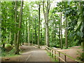
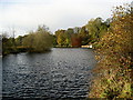
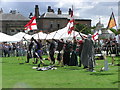
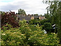
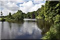
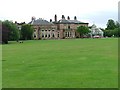
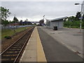
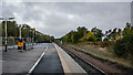
Photos of Eaglescliffe East Ward
Area Information
Living in Eaglescliffe East Ward means settling into a distinct district within the borough of Stockton-on-Tees. This area covers 9.1 square kilometres and stands out for its substantial proportion of older residents. The community reflects a mature demographic rather than a youthful one, creating a quiet and established environment. You are stepping into a neighbourhood where the rhythm of daily life is paced by a population with an average age of 70. This demographic skew shapes the local culture and the types of services that operate within the ward boundaries. Property searchers looking for a settled environment will find their requirements met here, as the area is defined by stability and long-term residency patterns. The identity of Eaglescliffe East Ward is rooted in its specific size and its clear social character. Prospective buyers should view this as a location designed for Retirement or those seeking a peaceful life away from urban chaos. The area does not offer the vibrancy of a high-growth zone; instead, it provides a consistent, predictable setting. Understanding the scale of 9.1 km² helps you visualise the layout, which likely favours residential streets over commercial sprawl. Your experience here will be heavily influenced by the prevailing age profile of the neighbours you meet down the road. This knowledge is essential for deciding if Wingscliffe East Ward aligns with your lifestyle goals.
- Area Type
- District Borough Unitary Ward
- Area Size
- 9.1 km²
- Population
- Not available
- Population Density
- Not available
Demographics
The community within Eaglescliffe East Ward exhibits clear characteristics regarding who calls it home. You will find that seven out of ten people in the ward are under the age of 70, a stark contrast to the national average. The most common age range recorded in the total population data highlights this dominance. Sixty-eight per cent of households in Eaglescliffe East Ward are owner-occupied, a figure that sets this area apart from many rental-heavy districts. This high rate of ownership suggests deep roots and a stable housing market. The data confirms that purchasing a home here is a common pathway for residents. Household composition totals reflect this stability, with families or single retirees likely to form the bulk of the population. There is no indication of a transient population or a large student demographic living in the ward. The ethnic makeup and religious affiliations present a diverse canvas, although the total counts for these groups are part of the broader census picture. You are entering a space where long-term residents have shaped the social fabric. The high ownership rate of 68% implies you are joining a community of invested homeowners rather than tenants. This structure often correlates with better maintenance of properties and a stronger sense of neighbourhood responsibility. When evaluating homes in Eaglescliffe East Ward, you are looking at a demographic environment that values permanence.
Household Size
Accommodation Type
Tenure
Ethnic Group
Religion
Household Composition
Age
Household Deprivation
NS-SEC
Explore more demographic insights in this area
Go to Demographics tabPlanning
Planning Constraints
- Flood RiskPremium
- Ramsar Wetland SitesPremium
- Area of Outstanding Natural BeautyPremium
- Protected Nature ReservePremium
- Protected WoodlandPremium