Area Overview for Duddo
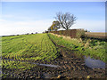
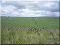
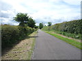
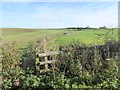
Photos of Duddo


Area Information
Duddo is a civil parish covering an area of 28.8 km² that offers a distinct rural character typical of the English countryside. Living in Duddo means embracing a quiet lifestyle where the daily rhythm is dictated by the natural surroundings rather than urban noise or congestion. The parish sits within a landscape that supports a low population density, creating a setting where privacy and space are standard features of daily life. This is not a bustling town centre location; rather, it is an established settlement known for its tranquility and connection to the wider natural environment. Prospective buyers are looking at a community where the pace of life slows down, allowing for a different kind of neighbourly interaction based on familiarity rather than proximity. The area functions as a self-contained unit where residents rely on local amenities and established routes. Anyone considering homes in Duddo must prepare for a life that values stillness and open spaces above all else. The geography of the parish defines the experience, offering a retreat from the faster pace of larger towns while remaining part of the broader county infrastructure.
- Area Type
- Parish
- Area Size
- 28.8 km²
- Population
- Not available
- Population Density
- Not available
Demographics
The community profile of Duddo reveals a settlement dominated by an older demographic. The median age here is 70, which indicates that the population consists largely of retirees or older residents rather than young families or workers in their prime. This age structure suggests a static population where many residents have lived in the area for decades. Households are primarily occupied by those in the broader age categories, reflecting a long-term commitment to the location. Home ownership is the defining characteristic of the area, with 63 per cent of properties owned outright or with a significant equity stake. This high rate of ownership points to a stable community where families have put down roots and are unlikely to move frequently. The lack of diverse population data underscores the homogeneity of the group living in Duddo. Quality of life remains high for those suited to this environment, as the domestic stability of the area supports a calm, predictable way of life. The demographic make-up is uniform, offering no ambiguity regarding the nature of the community you would join if you move here.
Household Size
Accommodation Type
Tenure
Ethnic Group
Religion
Household Composition
Age
Household Deprivation
NS-SEC
Explore more demographic insights in this area
Go to Demographics tabPlanning
Planning Constraints
- Flood RiskPremium
- Ramsar Wetland SitesPremium
- Area of Outstanding Natural BeautyPremium
- Protected Nature ReservePremium
- Protected WoodlandPremium