Area Overview for DL5 7LP
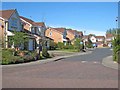
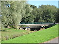
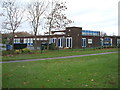
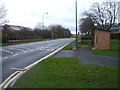
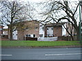
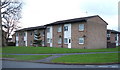
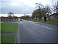
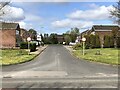
Photos of DL5 7LP


Area Information
Living in DL5 7LP means being part of a tightly knit residential cluster in England, where 1,316 people reside across 4,517 square metres. The area’s high population density — 291,314 people per square kilometre — reflects its compact nature, with homes clustered closely together. This postcode is defined by its small-scale living, where daily life revolves around nearby amenities and a strong sense of local identity. The community is predominantly composed of adults aged 30–64, with a median age of 47, suggesting a stable, mature population. Home ownership is high at 67%, indicating a preference for long-term residency. Residents benefit from proximity to essential services, including retail outlets and rail links, while the area’s low flood risk and below-average crime rates contribute to a sense of security. For those seeking a quiet, well-connected neighbourhood with practical living options, DL5 7LP offers a blend of accessibility and community focus.
- Area Type
- Postcode
- Area Size
- 4517 m²
- Population
- 1316
- Population Density
- 291314 people/km²
The property market in DL5 7LP is largely owner-occupied, with 67% of homes owned by residents rather than rented. The area is dominated by houses, which contrasts with regions where flats or apartments predominate. This suggests a market skewed towards family homes and long-term residency, with limited turnover. Given the postcode’s small size — just 4,517 square metres — the housing stock is finite, meaning buyers should consider the area’s immediate surroundings for more options. The high home ownership rate implies strong community ties, but it may also limit availability for new buyers. Those seeking a house in this area should act decisively, as the compact nature of DL5 7LP means competition can be fierce.
House Prices in DL5 7LP
Showing 2 properties
| Address | Type | Beds | Baths | Last Sale Price | Last Sale Date | |
|---|---|---|---|---|---|---|
| Flat 2, Walworth School, Bluebell Way, Newton Aycliffe, DL5 7LP | Flat | - | - | - | - | |
| Walworth School, Bluebell Way, Newton Aycliffe, DL5 7LP | commercial | - | - | - | - |
Energy Efficiency in DL5 7LP
Residents of DL5 7LP have access to essential retail outlets, including Morrisons Daily Newton, Sainsburys Cobblers, and other local stores, ensuring everyday shopping needs are met within reach. The area’s rail stations — Newton Aycliffe, Shildon, and Heighington — provide easy access to public transport, enhancing connectivity to wider regional services. While the data does not mention parks or leisure facilities, the proximity to rail and retail suggests a practical, service-oriented lifestyle. The compact nature of the area means amenities are closely clustered, offering convenience for daily errands and travel.
Amenities
Schools
The nearest school to DL5 7LP is Walworth School, a special school catering to students with specific educational needs. No other schools are listed in the data, so families with children requiring mainstream education may need to look further afield. The presence of a special school indicates the area’s capacity to support residents with diverse needs, though it does not provide a full range of educational options. Parents should consider the proximity of other schools in neighbouring areas, as the data does not include additional educational institutions.
| Rank | School | Type | Entry gender | Ages |
|---|
Explore more schools in this area
Go to Schools tabDemographics
DL5 7LP’s population is characterised by a median age of 47, with the majority of residents falling within the 30–64 age range. This suggests a community of established adults, likely with families or long-term careers. Home ownership is strong, with 67% of households owning their homes, compared to 33% renting. The area is predominantly composed of houses, reflecting a preference for single-family living over flats or apartments. The predominant ethnic group is White, though no specific data on diversity or deprivation is provided. The high proportion of adults in the 30–64 range may indicate a mature, stable population with established routines. This demographic profile shapes a community focused on practicality, with residents prioritising security, stability, and proximity to services.
Household Size
Accommodation Type
Tenure
Ethnic Group
Religion
Household Composition
Age
Household Deprivation
NS-SEC
Explore more demographic insights in this area
Go to Demographics tabPlanning
Planning Constraints
- Flood RiskPremium
- Ramsar Wetland SitesPremium
- Area of Outstanding Natural BeautyPremium
- Protected Nature ReservePremium
- Protected WoodlandPremium