Area Overview for DL5 6BJ
Photos of DL5 6BJ


Area Information
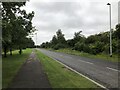
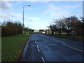
DL5 6BJ is a small, tightly knit residential postcode in England, home to around 1500 people spread across 206 residents per square kilometre. This area is characterised by its modest scale and focus on housing, with the majority of properties being houses rather than flats. The community here is predominantly composed of adults aged 30 to 64, with a median age of 47, suggesting a stable, mature population. Daily life in DL5 6BJ is shaped by its proximity to essential services, including multiple retail outlets and railway stations, which provide connectivity to nearby towns. While the area does not feature natural landscapes like AONBs or protected woodlands, its practical layout and access to schools and transport make it a viable choice for those seeking a balanced, low-maintenance lifestyle. The small population and focused housing stock mean the area is not densely built, offering a quieter, more intimate living environment compared to larger urban centres.
- Area Type
- Postcode
- Area Size
- Not available
- Population
- 1500
- Population Density
- 206 people/km²
DL5 6BJ is primarily an owner-occupied area, with 61% of residents living in homes they own. The housing stock consists entirely of houses, which is unusual for a small postcode but aligns with the area’s focus on residential stability. This suggests a market where properties are likely to be family homes rather than investment properties or rental units. The limited number of properties—given the small population—means the area is not a large-scale housing market. For buyers, this could present both opportunities and challenges: the scarcity of properties may limit choice, but the presence of homes rather than flats could appeal to those seeking more space. Proximity to schools and transport links may also enhance the area’s appeal, though buyers should consider the lack of natural amenities and the potential for limited future development.
House Prices in DL5 6BJ
No properties found in this postcode.
Energy Efficiency in DL5 6BJ
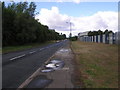
Residents of DL5 6BJ have access to several retail amenities, including Morrisons Daily, Morrisons Daily Newton, and other unnamed stores, providing convenience for everyday shopping. The area’s rail connections to Heighington, Newton Aycliffe, and Shildon enhance mobility, making it easier to reach larger towns for leisure, dining, or specialist services. While the data does not mention parks or recreational facilities, the presence of multiple retail outlets and transport links suggests a practical, service-oriented lifestyle. The area’s small size means amenities are closely clustered, reducing the need for long commutes. However, the absence of named parks or leisure venues implies that outdoor activities may require travel beyond the immediate postcode. Overall, the lifestyle in DL5 6BJ is defined by accessibility to retail and transport, with a focus on functional convenience.
Amenities
Schools
Residents of DL5 6BJ have access to Aycliffe Village Primary and Nursery School, a primary school that serves younger children, and UTC South Durham, a secondary school with a Good Ofsted rating. The presence of both primary and secondary education options within reach makes the area suitable for families requiring a full range of schooling. UTC South Durham’s Good rating indicates a school that meets national standards, offering a reliable educational environment. However, the repetition of Aycliffe Village Primary in the data suggests a possible oversight, though the availability of two schools at different levels is a clear advantage. Families moving to DL5 6BJ can reasonably expect their children to attend these institutions, which are likely to be well-served by local infrastructure and community support.
| Rank | School | Type | Entry gender | Ages |
|---|
Explore more schools in this area
Go to Schools tabDemographics
The population of DL5 6BJ is predominantly adults aged 30 to 64, with a median age of 47. This suggests a community that is largely settled, with fewer young families or retirees compared to other areas. Home ownership stands at 61%, indicating that most residents live in properties they own, rather than renting. The accommodation type is exclusively houses, which aligns with the area’s residential character. The predominant ethnic group is White, reflecting a homogenous demographic profile. While no specific data on deprivation is provided, the high home ownership rate and stable age distribution suggest a relatively stable economic environment. However, the lack of diversity in ethnicity and the absence of detailed socioeconomic breakdowns mean the area’s broader social dynamics remain less defined.
Household Size
Accommodation Type
Tenure
Ethnic Group
Religion
Household Composition
Age
Household Deprivation
NS-SEC
Explore more demographic insights in this area
Go to Demographics tabPlanning
Planning Constraints
- Flood RiskPremium
- Ramsar Wetland SitesPremium
- Area of Outstanding Natural BeautyPremium
- Protected Nature ReservePremium
- Protected WoodlandPremium