Area Overview for DL4 2JS
Photos of DL4 2JS
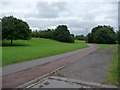
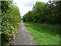
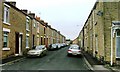
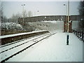
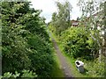

100 photos from this area
Area Information
Key information about the DL4 2JS including its size, population, and administrative classification.
- Area Type
- Postcode
- Area Size
- 5059 m²
- Population
- 1816
- Population Density
- 296 people/km²
House Prices in DL4 2JS
25
Properties
£56,861
Average Sold Price
£35,000
Lowest Price
£96,500
Highest Price
Showing 25 properties
| Address | Type | Beds | Baths | Last Sale Price | Last Sale Date | |
|---|---|---|---|---|---|---|
| 98 Redworth Road, Shildon, DL4 2JS | Terraced | 3 | 1 | £58,000 | Jan 2025 | |
| 112 Redworth Road, Shildon, DL4 2JS | house | 3 | 1 | £83,000 | Oct 2024 | |
| 92 Redworth Road, Shildon, DL4 2JS | Terraced | 3 | 1 | £56,000 | May 2024 | |
| 126 Redworth Road, Shildon, DL4 2JS | Terraced | 4 | 1 | £61,000 | Jun 2023 | |
| 116 Redworth Road, Shildon, DL4 2JS | Terraced | 2 | 1 | £59,995 | Jun 2022 | |
| 124 Redworth Road, Shildon, DL4 2JS | Terraced | - | - | £82,500 | Mar 2022 | |
| 80 Redworth Road, Shildon, DL4 2JS | house | - | - | £69,000 | Dec 2021 | |
| 110 Redworth Road, Shildon, DL4 2JS | Terraced | 2 | 1 | £37,500 | Mar 2020 | |
| 88 Redworth Road, Shildon, DL4 2JS | Terraced | 3 | - | £41,000 | Jun 2019 | |
| 102 Redworth Road, Shildon, DL4 2JS | Terraced | 4 | 2 | £67,550 | Dec 2016 |
Page 1 of 3
Energy Efficiency in DL4 2JS
Amenities
Schools
| Rank | School | Type | Entry gender | Ages |
|---|
Explore more schools in this area
Go to Schools tabDemographics
Household Size
One person
most common
Accommodation Type
Houses
most common
Tenure
52
majority
Ethnic Group
White
most common
Religion
N/A
most common
Household Composition
N/A
most common
Age
47
median
Adults (30-64 years)
most common
Household Deprivation
N/A
with no deprivation
NS-SEC
19
in Lower managerial occupations
Explore more demographic insights in this area
Go to Demographics tabPlanning
Planning Constraints
- Flood RiskPremium
- Ramsar Wetland SitesPremium
- Area of Outstanding Natural BeautyPremium
- Protected Nature ReservePremium
- Protected WoodlandPremium