Area Overview for DL3 8TF
Photos of DL3 8TF
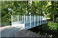
![Broken Scar Pumping and Filtration Works [1] in DL3 8TF](https://images.propbar.co.uk/images/geograph/75/86/7586680_120.jpg)

18 photos from this area
Area Information
Key information about the DL3 8TF including its size, population, and administrative classification.
- Area Type
- Postcode
- Area Size
- 16.6 hectares
- Population
- 1608
- Population Density
- 1471 people/km²
House Prices in DL3 8TF
9
Properties
-
Average Sold Price
-
Lowest Price
-
Highest Price
Showing 9 properties
| Address | Type | Beds | Baths | Last Sale Price | Last Sale Date | |
|---|---|---|---|---|---|---|
| Aes Limited, Broken Scar Water Treatment Works, Coniscliffe Road, Darlington, DL3 8TF | Industrial | - | - | - | - | |
| Ondeo Industrial Solutions, Broken Scar Water Treatment Works, Coniscliffe Road, Darlington, DL3 8TF | Industrial | - | - | - | - | |
| Eden Springs Uk Limited, Coniscliffe Road, Darlington, DL3 8TF | Industrial | - | - | - | - | |
| Northumbrian Water Limited, Broken Scar Water Treatment Works, Coniscliffe Road, Darlington, DL3 8TF | Industrial | - | - | - | - | |
| Tees Cottage, Coniscliffe Road, Darlington, DL3 8TF | Leisure | - | - | - | - | |
| Firbank House, Coniscliffe Road, Darlington, DL3 8TF | Detached | - | - | - | - | |
| Eden Springs Uk Ltd, Northumbria House, Coniscliffe Road, Darlington, DL3 8TF | storage_distribution | - | - | - | - | |
| Embleton View, West Gate House, Coniscliffe Road, Darlington, DL3 8TF | education | - | - | - | - | |
| Beam Engine House, Tees Cottage Pumping Station, Coniscliffe Road, Darlington, DL3 8TF | Leisure | - | - | - | - |
Energy Efficiency in DL3 8TF
Amenities
Schools
| Rank | School | Type | Entry gender | Ages |
|---|
Explore more schools in this area
Go to Schools tabDemographics
Household Size
Two person
most common
Accommodation Type
Houses
most common
Tenure
80
majority
Ethnic Group
White
most common
Religion
N/A
most common
Household Composition
N/A
most common
Age
47
median
Elderly (65+ years)
most common
Household Deprivation
N/A
with no deprivation
NS-SEC
46
in Lower managerial occupations
Explore more demographic insights in this area
Go to Demographics tabPlanning
Planning Constraints
- Flood RiskPremium
- Ramsar Wetland SitesPremium
- Area of Outstanding Natural BeautyPremium
- Protected Nature ReservePremium
- Protected WoodlandPremium