Area Overview for DL3 7BP
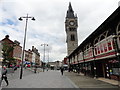
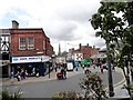
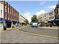
Photos of DL3 7BP


Area Information
DL3 7BP is a compact residential cluster centred on a specific postcode covering approximately 49,950 square metres. This small area supports a population of 2,098 people, resulting in a population density of 1,855 people per square kilometre. The location functions as a tightly knit neighbourhood where daily life revolves around proximity to nearby transport hubs and retail outlets. Residents find themselves in close reach of Darlington Railway Station and Dinsdale Railway Station, which facilitate easy access to wider commuting networks. The area blends quiet residential streets with convenient utility access, positioned just miles from Durham Tees Valley Airport. You do not need to travel far for essentials, as major supermarkets like Sainsburys Darlington and Tesco Cornmill are within practical walking or short driving distance. The postcode occupies a niche market in Darlington, appealing to those seeking a defined community feel without the sprawl of larger towns. Living in DL3 7BP means prioritising convenience and connectivity, with five rail stations and five retail points located nearby to support your daily routine.
- Area Type
- Postcode
- Area Size
- 4495 m²
- Population
- 2098
- Population Density
- 1855 people/km²
Homes in DL3 7BP are characterised by a specific stock profile dominated by flats rather than detached or semi-detached houses. This accommodation type suits the dense layout of a postcode covering such a small geographical footprint. With only 24% of the area in owner-occupied housing, the vast majority of properties operate within the private rental sector. This market dynamic means you are likely to encounter a high turnover of tenants rather than long-term resident owners. If you are considering purchasing here, the low ownership rate signals an investment opportunity centred on rental yield rather than capital accumulation through residency. The housing stock is tailored to individuals who require modern, low-maintenance living spaces close to transport links. You should expect a concentration of purpose-built units designed for urban dwellers who value proximity to work and leisure amenities over garden space. The property market here is driven by demand from those seeking entry-level living or short-term rentals near Darlington Railway Station.
House Prices in DL3 7BP
Showing 14 properties
| Address | Type | Beds | Baths | Last Sale Price | Last Sale Date | |
|---|---|---|---|---|---|---|
| 7 Portland Place, Darlington, DL3 7BP | Terraced | 2 | 1 | £85,000 | Sep 2019 | |
| 6 Portland Place, Darlington, DL3 7BP | house | - | - | £76,500 | Nov 2013 | |
| 1A Portland Place, Darlington, DL3 7BP | Terraced | 2 | - | £89,000 | Apr 2007 | |
| 9 Portland Place, Darlington, DL3 7BP | house | 2 | 1 | £98,000 | Apr 2005 | |
| 11 Portland Place, Darlington, DL3 7BP | house | - | - | £26,000 | Sep 2002 | |
| 5 Portland Place, Darlington, DL3 7BP | house | - | - | £18,825 | Jul 1997 | |
| 15 Portland Place, Darlington, DL3 7BP | Terraced | - | - | £29,450 | May 1997 | |
| 19 Portland Place, Darlington, DL3 7BP | house | 1 | - | - | - | |
| 3B Portland Place, Darlington, DL3 7BP | Flat | - | - | - | - | |
| 3A Portland Place, Darlington, DL3 7BP | Terraced | 1 | 1 | - | - |
Energy Efficiency in DL3 7BP
Residents of DL3 7BP enjoy immediate access to a range of retail, rail, and aviation amenities within practical reach. Your daily shopping trips can be handled at nearby venues such as Sainsburys Darlington, M&S Darlington WHS, and Tesco Cornmill. These five retail locations provide comprehensive groceries, clothing, and household essentials without the need for a long commute. Transport links are equally convenient, with five railway stations situated close by, including Darlington Railway Station, North Road Railway Station, and Dinsdale Railway Station. Travelers can also take advantage of two nearby aviation hubs, specifically Durham Tees Valley Airport, for domestic flights. This concentration of amenities creates a lifestyle where work, leisure, and travel needs are all met within a short distance. Living in this postcode means you have five key transport nodes and five major retail points at your doorstep.
Amenities
Schools
Education options near DL3 7BP are centred on pre-school provision rather than primary or secondary institutions. The neighbourhood school nearest to this postcode is Borough Road Nursery School, which serves as a facility for very young children. As a nursery, this institution caters to toddlers and preschoolers, making it a vital resource for parents in the 30 to 64 age bracket who dominate the local demographics. There are no primary or secondary schools listed in the immediate vicinity of this specific cluster. Families living here typically send their older children to schools in the wider Darlington area. For early education, the location offers direct access to Borough Road Nursery School, ensuring convenient drop-offs and pick-ups for the youngest members of households. The reliance on a single nursery type means that parents must look beyond the immediate postcode for comprehensive schooling from ages five upwards.
| Rank | School | Type | Entry gender | Ages |
|---|
Explore more schools in this area
Go to Schools tabDemographics
The community within DL3 7BP is defined by a mature demographic profile, with a median age of 47 years. The most common age group comprises adults between 30 and 64 years old, suggesting a household structure dominated by working families or established professionals moving into later career stages. Accommodation in this postcode area consists primarily of flats, which aligns with the high-density living style of such a compact cluster. Home ownership stands at 24%, a figure that places the area firmly in rental territory rather than owner-occupied. This suggests that many residents are likely tenants, which can influence community dynamics and investment strategies for buyers. The predominant ethnic group is White, reflecting the demographic composition of the broader Darlington region. You are joining a community where the average resident is well-established in their career and life cycle. The low rate of home ownership indicates a market where investment lets or purpose-built flats play a dominant role in the social fabric. Understanding these statistics helps you gauge the type of neighbours you might meet and the stability of the local tenant base.
Household Size
Accommodation Type
Tenure
Ethnic Group
Religion
Household Composition
Age
Household Deprivation
NS-SEC
Explore more demographic insights in this area
Go to Demographics tabPlanning
Planning Constraints
- Flood RiskPremium
- Ramsar Wetland SitesPremium
- Area of Outstanding Natural BeautyPremium
- Protected Nature ReservePremium
- Protected WoodlandPremium