Area Overview for DL2 3ER
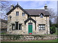
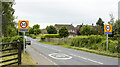
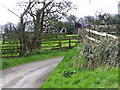
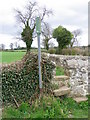
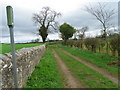
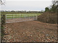
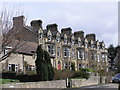
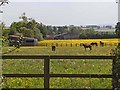
Photos of DL2 3ER


Area Information
Living in DL2 3ER means being part of a small, tightly knit residential cluster in England, where 2,345 people reside across a low-density area of 51 people per square kilometre. This postcode is characterised by a calm, suburban atmosphere, with homes predominantly occupied by owners rather than renters. The area’s population skews towards adults aged 30–64, suggesting a community of professionals and families seeking stability. With no major environmental constraints or flood risks, DL2 3ER offers a secure base for daily life. Proximity to primary schools like Gainford CofE Primary and Ingleton CofE Primary ensures children have access to local education. While the area lacks large-scale amenities, its low crime rate and absence of planning restrictions make it appealing for those prioritising safety and simplicity. The blend of modest home ownership and a mature demographic creates a quiet, unassuming neighbourhood where familiarity and routine are key.
- Area Type
- Postcode
- Area Size
- Not available
- Population
- 2345
- Population Density
- 51 people/km²
DL2 3ER is primarily an owner-occupied area, with 73% of homes owned by residents rather than rented out. The housing stock consists almost entirely of houses, not flats or apartments, which is typical of smaller, suburban postcode areas. This suggests a market focused on family homes rather than high-density living. The low population density of 51 people per square kilometre indicates spacious properties with potential for gardens or outdoor space. For buyers, this means a limited number of properties available, but with fewer planning constraints and environmental risks. The area’s small size means the immediate surroundings are likely to mirror its characteristics, offering a consistent housing experience. However, the lack of rental properties may make it less attractive to those seeking short-term or flexible housing options.
House Prices in DL2 3ER
No properties found in this postcode.
Energy Efficiency in DL2 3ER
The lifestyle in DL2 3ER is defined by its modest retail offerings and community-focused amenities. Nearby shops include Spar, Morrisons Daily, and Co-op Cockfield, providing essentials for daily living. These venues support a practical, localised approach to shopping, reducing the need for long trips to larger centres. While the area lacks larger leisure facilities or parks, the absence of environmental constraints means residents can enjoy outdoor activities without restrictions. The presence of multiple primary schools reinforces a family-oriented environment, with local services catering to children’s needs. The character of DL2 3ER is one of simplicity and convenience, where proximity to essentials and a low crime rate contribute to a peaceful, routine-driven lifestyle.
Amenities
Schools
Residents of DL2 3ER have access to several primary schools, including Gainford CofE Primary School and Preschool, Gainford Church of England Primary School and Preschool, and Ingleton CofE Primary School. These institutions cater to younger children, providing a range of local education options. While no Ofsted ratings are provided, the presence of multiple primary schools suggests a focus on early education within the community. Families with young children will find these schools conveniently located, reducing the need for long commutes. The repetition of school names may indicate proximity or shared catchment areas, though specific details on school performance or capacity are not available. For parents prioritising local schooling, DL2 3ER offers a reliable network of primary education.
| Rank | School | Type | Entry gender | Ages |
|---|
Explore more schools in this area
Go to Schools tabDemographics
DL2 3ER’s population is predominantly adults aged 30–64, with a median age of 47. This suggests a community of established professionals and families, rather than a younger, transient population. Home ownership is high, at 73%, indicating a strong preference for long-term residency over renting. The area’s accommodation is largely houses, not flats, reflecting a more traditional housing stock. The predominant ethnic group is White, though no specific diversity statistics are provided. With no data on deprivation, it is unclear how economic factors influence quality of life, but the low population density and absence of environmental risks suggest a relatively uniform standard of living. The age profile implies a stable, mature demographic, which may influence local services and social dynamics.
Household Size
Accommodation Type
Tenure
Ethnic Group
Religion
Household Composition
Age
Household Deprivation
NS-SEC
Explore more demographic insights in this area
Go to Demographics tabPlanning
Planning Constraints
- Flood RiskPremium
- Ramsar Wetland SitesPremium
- Area of Outstanding Natural BeautyPremium
- Protected Nature ReservePremium
- Protected WoodlandPremium