Area Overview for DL2 2UX
Photos of DL2 2UX
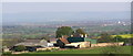
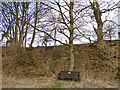
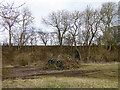
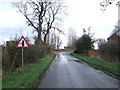
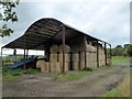
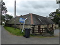
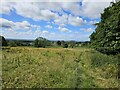
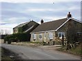
18 photos from this area
Area Information
Key information about the DL2 2UX including its size, population, and administrative classification.
- Area Type
- Postcode
- Area Size
- 1.1 km²
- Population
- 2705
- Population Density
- 45 people/km²
House Prices in DL2 2UX
8
Properties
£701,334
Average Sold Price
£270,000
Lowest Price
£1,434,001
Highest Price
Showing 8 properties
| Address | Type | Beds | Baths | Last Sale Price | Last Sale Date | |
|---|---|---|---|---|---|---|
| Lavender Cottage, Highside Road, Heighington, DL2 2UX | Semi-detached | 3 | 2 | £400,000 | Jul 2022 | |
| Halliwell Farm, Highside Road, Heighington, DL2 2UX | house | - | - | £1,434,001 | Jan 2022 | |
| Highside Byre, Highside Road, Heighington, DL2 2UX | Detached | - | - | £270,000 | Mar 2009 | |
| Park House Farm, Highside Road, Heighington, DL2 2UX | house | 3 | - | - | - | |
| Highside Grange, Highside Road, Heighington, DL2 2UX | house | - | - | - | - | |
| Highside Farm, Highside Road, Heighington, DL2 2UX | house | - | - | - | - | |
| West Lodge, Highside Road, Heighington, DL2 2UX | Detached | - | - | - | - | |
| Caravan, Park House Farm, Highside Road, Heighington, DL2 2UX | Mobile Home | - | - | - | - |
Energy Efficiency in DL2 2UX
Amenities
Schools
| Rank | School | Type | Entry gender | Ages |
|---|
Explore more schools in this area
Go to Schools tabDemographics
Household Size
Family (3-5 people)
most common
Accommodation Type
Houses
most common
Tenure
81
majority
Ethnic Group
White
most common
Religion
N/A
most common
Household Composition
N/A
most common
Age
47
median
Adults (30-64 years)
most common
Household Deprivation
N/A
with no deprivation
NS-SEC
43
in Lower managerial occupations
Explore more demographic insights in this area
Go to Demographics tabPlanning
Planning Constraints
- Flood RiskPremium
- Ramsar Wetland SitesPremium
- Area of Outstanding Natural BeautyPremium
- Protected Nature ReservePremium
- Protected WoodlandPremium