Area Overview for DL2 2FD
Photos of DL2 2FD


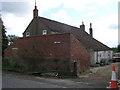
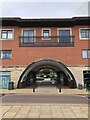
12 photos from this area
Area Information
Key information about the DL2 2FD including its size, population, and administrative classification.
- Area Type
- Postcode
- Area Size
- 2.8 hectares
- Population
- 1762
- Population Density
- 1196 people/km²
House Prices in DL2 2FD
90
Properties
£180,618
Average Sold Price
£69,500
Lowest Price
£282,000
Highest Price
Showing 90 properties
| Address | Type | Beds | Baths | Last Sale Price | Last Sale Date | |
|---|---|---|---|---|---|---|
| 37 Collingsway, Darlington, DL2 2FD | Flat | 1 | 1 | £69,500 | Nov 2025 | |
| 8 Collingsway, Darlington, DL2 2FD | Flat | 2 | 2 | £100,000 | Oct 2025 | |
| 20 Collingsway, Darlington, DL2 2FD | Semi-detached | 4 | 3 | £282,000 | Jul 2025 | |
| 16 Collingsway, Darlington, DL2 2FD | Flat | 1 | 1 | £83,000 | Jul 2025 | |
| 59 Collingsway, Darlington, DL2 2FD | Terraced | 3 | 2 | £170,000 | Jun 2025 | |
| 49 Collingsway, Darlington, DL2 2FD | Flat | 2 | 2 | £100,000 | Apr 2025 | |
| 25 Collingsway, Darlington, DL2 2FD | Terraced | 3 | 2 | £183,000 | Mar 2025 | |
| 21 Collingsway, Darlington, DL2 2FD | Terraced | 3 | 2 | £185,000 | Feb 2025 | |
| 9 Collingsway, Darlington, DL2 2FD | Semi-detached | 3 | 2 | £188,000 | Oct 2024 | |
| 65 Collingsway, Darlington, DL2 2FD | Semi-detached | 3 | 2 | £240,000 | Aug 2024 |
Page 1 of 9
Energy Efficiency in DL2 2FD
Amenities
Schools
| Rank | School | Type | Entry gender | Ages |
|---|
Explore more schools in this area
Go to Schools tabDemographics
Household Size
Family (3-5 people)
most common
Accommodation Type
Houses
most common
Tenure
68
majority
Ethnic Group
White
most common
Religion
N/A
most common
Household Composition
N/A
most common
Age
47
median
Adults (30-64 years)
most common
Household Deprivation
N/A
with no deprivation
NS-SEC
43
in Lower managerial occupations
Explore more demographic insights in this area
Go to Demographics tabPlanning
Planning Constraints
- Flood RiskPremium
- Ramsar Wetland SitesPremium
- Area of Outstanding Natural BeautyPremium
- Protected Nature ReservePremium
- Protected WoodlandPremium