Area Overview for DL2 1WW
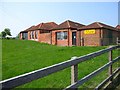
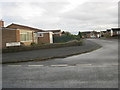
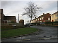
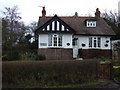
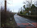
Photos of DL2 1WW

Area Information
Living in DL2 1WW means being part of a small, low-density residential cluster in England, where the population of 1982 residents spreads across 30 people per square kilometre. This area is characterised by its quiet, mature community, with a median age of 47 and a strong presence of adults aged 30–64. The housing stock is predominantly owner-occupied, with 81% of homes owned by residents, suggesting a stable, long-term population. Daily life here is shaped by proximity to essential services, including two primary schools and a network of retail and transport links. The area’s compact size fosters a tight-knit feel, with residents likely to know their neighbours. While it lacks the vibrancy of larger towns, its low population density offers space and tranquillity. For those seeking a settled, family-friendly environment with access to nearby amenities, DL2 1WW provides a balance of privacy and practicality. The presence of nearby rail stations and two airports within reach adds to its connectivity, making it a viable option for commuters or those needing regular travel.
- Area Type
- Postcode
- Area Size
- Not available
- Population
- 1982
- Population Density
- 30 people/km²
The property market in DL2 1WW is dominated by owner-occupied homes, with 81% of properties owned by residents. This high ownership rate indicates a stable, long-term community with limited rental activity. The accommodation type is primarily houses, which contrasts with areas where flats or apartments dominate. This suggests a residential area designed for families or individuals seeking space and privacy. Given the small size of the postcode area, the housing stock is likely limited, meaning buyers may need to consider nearby regions for additional options. The prevalence of houses also implies that properties here are likely to be larger than average, catering to those prioritising living space over urban convenience. For buyers, this market offers a chance to purchase in a low-density, established area, though competition for properties may be higher due to the area’s appeal to long-term residents.
House Prices in DL2 1WW
No properties found in this postcode.
Energy Efficiency in DL2 1WW
Residents of DL2 1WW enjoy access to a range of practical amenities within reach. Retail options include Sainsburys Middleton, Asda Darlington, and Morrisons Daily, ensuring everyday shopping needs are met. The area’s rail links, such as Dinsdale and Durham Tees Valley stations, connect to broader transport networks, while the nearby Durham Tees Valley Airport offers regional and national travel. Though the data does not mention parks or leisure facilities, the presence of multiple retail and transport hubs suggests a functional lifestyle. The area’s small size means amenities are concentrated, reducing the need for long commutes. For those prioritising convenience, DL2 1WW provides a mix of essential services, though leisure options may require venturing slightly further afield. The combination of retail, transport, and proximity to airports makes this area practical for both daily living and occasional travel.
Amenities
Schools
Residents of DL2 1WW have access to two primary schools within practical reach: Bishopton Redmarshall CofE Primary School and Sadberge CofE Primary School. The former holds an Ofsted rating of ‘good’, indicating a strong educational standard, while the latter is also a primary school but lacks an explicit rating in the data. Both schools serve the local community, providing essential early education for families. The presence of two primary schools suggests that parents have options for their children’s schooling, though secondary education facilities are not listed in the data. For families prioritising proximity to schools, this area offers a reliable foundation for a child’s education. However, the absence of secondary school information means buyers may need to consider wider commuting options for older children. The ‘good’ rating at Bishopton Redmarshall adds a layer of reassurance for those seeking quality primary education.
| Rank | School | Type | Entry gender | Ages |
|---|
Explore more schools in this area
Go to Schools tabDemographics
The community in DL2 1WW is predominantly composed of adults aged 30–64, with a median age of 47. This suggests a mature, established population, likely with strong family ties and long-term residency. Home ownership is high, at 81%, indicating a stable housing market with few rental properties. The accommodation is primarily houses, which aligns with the area’s low density and residential character. The predominant ethnic group is White, reflecting a homogenous demographic profile. While no data on deprivation is provided, the high home ownership rate and mature age profile suggest a community with relatively stable economic conditions. However, the absence of specific diversity statistics means the area’s cultural composition remains less defined. For prospective buyers, this demographic profile implies a neighbourhood with a focus on long-term living rather than transient populations, offering a sense of continuity and community cohesion.
Household Size
Accommodation Type
Tenure
Ethnic Group
Religion
Household Composition
Age
Household Deprivation
NS-SEC
Explore more demographic insights in this area
Go to Demographics tabPlanning
Planning Constraints
- Flood RiskPremium
- Ramsar Wetland SitesPremium
- Area of Outstanding Natural BeautyPremium
- Protected Nature ReservePremium
- Protected WoodlandPremium