Area Overview for DL2 1QD
Photos of DL2 1QD
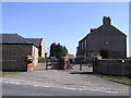
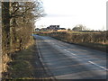
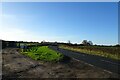
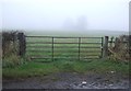


10 photos from this area
Area Information
Key information about the DL2 1QD including its size, population, and administrative classification.
- Area Type
- Postcode
- Area Size
- 1.6 km²
- Population
- 2149
- Population Density
- 105 people/km²
House Prices in DL2 1QD
14
Properties
£502,316
Average Sold Price
£84,211
Lowest Price
£1,380,000
Highest Price
Showing 14 properties
| Address | Type | Beds | Baths | Last Sale Price | Last Sale Date | |
|---|---|---|---|---|---|---|
| Holdforth Grange, Roundhill Road, Hurworth Moor, Darlington, DL2 1QD | house | - | - | £1,380,000 | Dec 2021 | |
| Willow Nook, Roundhill Road, Hurworth Moor, Darlington, DL2 1QD | Bungalow | - | - | £400,000 | May 2021 | |
| Waterside, Roundhill Road, Hurworth Moor, Darlington, DL2 1QD | Semi-detached | 4 | 3 | £440,000 | Nov 2016 | |
| COPSE HAVEN, ROUNDHILL ROAD, Hurworth Moor, Darlington, DL2 1QD | Bungalow | 4 | - | £427,000 | Apr 2011 | |
| Meadowbrooke, Roundhill Road, Hurworth Moor, Darlington, DL2 1QD | house | 4 | - | £425,000 | Mar 2004 | |
| Roundhill Farm, Roundhill Road, Hurworth Moor, Darlington, DL2 1QD | house | - | - | £360,000 | Jul 2002 | |
| Creebeck Farm, Burma Road, Hurworth Moor, Darlington, DL2 1QD | house | - | - | £84,211 | Mar 2001 | |
| Ashfield Farm, Roundhill Road, Hurworth Moor, Darlington, DL2 1QD | Detached | - | - | - | - | |
| Hansofli Barn, Roundhill Road, Hurworth Moor, Darlington, DL2 1QD | Bungalow | - | - | - | - | |
| Caravan 2, Oakwood Farm, Roundhill Road, Hurworth Moor, Darlington, DL2 1QD | Mobile Home | - | - | - | - |
Page 1 of 2
Energy Efficiency in DL2 1QD
Amenities
Schools
| Rank | School | Type | Entry gender | Ages |
|---|
Explore more schools in this area
Go to Schools tabDemographics
Household Size
Two person
most common
Accommodation Type
Houses
most common
Tenure
70
majority
Ethnic Group
White
most common
Religion
N/A
most common
Household Composition
N/A
most common
Age
47
median
Adults (30-64 years)
most common
Household Deprivation
N/A
with no deprivation
NS-SEC
36
in Lower managerial occupations
Explore more demographic insights in this area
Go to Demographics tabPlanning
Planning Constraints
- Flood RiskPremium
- Ramsar Wetland SitesPremium
- Area of Outstanding Natural BeautyPremium
- Protected Nature ReservePremium
- Protected WoodlandPremium