Area Overview for DL17 9PA
Photos of DL17 9PA
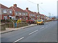
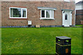
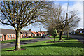
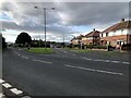
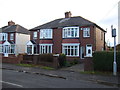
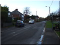
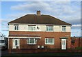
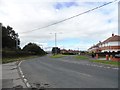
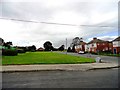
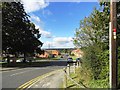
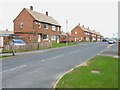
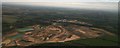
12 photos from this area
Area Information
Key information about the DL17 9PA including its size, population, and administrative classification.
- Area Type
- Postcode
- Area Size
- 1.3 hectares
- Population
- 2425
- Population Density
- 361 people/km²
House Prices in DL17 9PA
39
Properties
£74,991
Average Sold Price
£32,000
Lowest Price
£119,950
Highest Price
Showing 39 properties
| Address | Type | Beds | Baths | Last Sale Price | Last Sale Date | |
|---|---|---|---|---|---|---|
| 52 Lichfield Road, West Cornforth, DL17 9PA | Semi-detached | 3 | 1 | £68,500 | Jun 2025 | |
| 16 Lichfield Road, West Cornforth, DL17 9PA | Semi-detached | 3 | 1 | £119,950 | Nov 2024 | |
| 50 Lichfield Road, West Cornforth, DL17 9PA | house | - | - | £85,000 | Jun 2024 | |
| 72 Lichfield Road, West Cornforth, DL17 9PA | Semi-detached | 3 | 1 | £110,000 | Aug 2023 | |
| 58 Lichfield Road, West Cornforth, DL17 9PA | house | - | - | £107,000 | Sep 2022 | |
| 80 Lichfield Road, West Cornforth, DL17 9PA | Semi-detached | 2 | 1 | £92,950 | Aug 2022 | |
| 82 Lichfield Road, West Cornforth, DL17 9PA | house | 2 | - | £80,000 | Aug 2022 | |
| 62 Lichfield Road, West Cornforth, DL17 9PA | Semi-detached | 3 | - | £87,500 | Jan 2021 | |
| 64 Lichfield Road, West Cornforth, DL17 9PA | house | - | - | £75,000 | Feb 2019 | |
| 46 Lichfield Road, West Cornforth, DL17 9PA | Semi-detached | 3 | 1 | £49,000 | Nov 2017 |
Page 1 of 4
Energy Efficiency in DL17 9PA
Amenities
Schools
| Rank | School | Type | Entry gender | Ages |
|---|
Explore more schools in this area
Go to Schools tabDemographics
Household Size
One person
most common
Accommodation Type
Houses
most common
Tenure
51
majority
Ethnic Group
White
most common
Religion
N/A
most common
Household Composition
N/A
most common
Age
47
median
Adults (30-64 years)
most common
Household Deprivation
N/A
with no deprivation
NS-SEC
20
in Lower managerial occupations
Explore more demographic insights in this area
Go to Demographics tabPlanning
Planning Constraints
- Flood RiskPremium
- Ramsar Wetland SitesPremium
- Area of Outstanding Natural BeautyPremium
- Protected Nature ReservePremium
- Protected WoodlandPremium