Area Overview for DL17 9BP
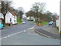
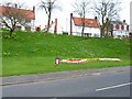
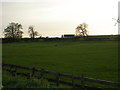
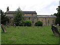
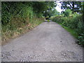
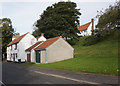
Photos of DL17 9BP


Area Information
DL17 9BP is a small, tightly knit residential postcode in England, home to 1,259 people spread across a low-density area of 124 people per square kilometre. This suggests a quiet, community-focused environment where neighbours are likely to know each other. The area’s compact size means daily life is centred around local amenities and nearby towns. With a median age of 47, the population skews towards adults aged 30–64, indicating a stable demographic with established households. The high home ownership rate of 77% and predominance of houses over flats suggest a traditional, family-oriented character. Residents benefit from proximity to St Michael’s Church of England Primary School and nearby retail hubs like Sainsburys Ferryhill, while the Newton Aycliffe Railway Station offers regional connectivity. The area’s low crime risk and absence of environmental constraints make it appealing for those prioritising safety and practical living.
- Area Type
- Postcode
- Area Size
- Not available
- Population
- 1259
- Population Density
- 124 people/km²
DL17 9BP is a small area with a strong emphasis on owner-occupied homes, with 77% of properties owned by residents rather than rented. The accommodation type is predominantly houses, which is unusual for areas with higher flat density. This suggests a market skewed towards family homes and long-term residency rather than short-term rental properties. The limited size of the area means the housing stock is likely to be uniform in style and age, with fewer new developments. For buyers, this could mean a niche market with limited choice but potentially stable property values. The proximity to nearby towns like Sedgefield might also influence property prices, as commuters could seek homes here with access to regional amenities.
House Prices in DL17 9BP
No properties found in this postcode.
Energy Efficiency in DL17 9BP
DL17 9BP’s residents have access to a range of nearby amenities, including five retail outlets such as Spar Bradbury and Sainsburys Ferryhill, which offer everyday shopping needs. The Newton Aycliffe Railway Station provides regional transport links, though the area itself lacks larger leisure facilities or parks. The presence of two primary schools and proximity to Sedgefield suggest a balance between local convenience and access to broader services. The low population density and small size of the area mean that daily life is likely to be quiet and community-focused, with limited need for long commutes. However, the absence of specific data on dining or entertainment options means the full range of lifestyle offerings remains unclear.
Amenities
Schools
DL17 9BP is served by two primary schools: St Michael’s C of E Primary School and St Michael’s Church of England Primary School. Both are likely to cater to the local community’s children, though the exact Ofsted ratings are not provided. The presence of two primary schools in a small area suggests a focus on local education, reducing the need for long commutes to secondary schools. Families with young children may benefit from the proximity of these schools, though the lack of secondary education options within the postcode means older students would need to travel to nearby towns. The dual presence of similarly named schools could indicate a shared governance structure or a single institution with multiple campuses.
| Rank | School | Type | Entry gender | Ages |
|---|
Explore more schools in this area
Go to Schools tabDemographics
DL17 9BP’s population is predominantly adults aged 30–64, with a median age of 47, reflecting a mature, settled community. Home ownership is high at 77%, and the accommodation is largely houses rather than flats, which is typical of rural or semi-rural areas. The predominant ethnic group is White, which aligns with broader regional trends. This demographic profile suggests a community focused on long-term stability rather than transient populations. The age range indicates a mix of families with school-age children and older adults, though the absence of specific data on deprivation means it is unclear how economic pressures might affect quality of life. The low population density also implies a quieter, less crowded environment compared to urban centres.
Household Size
Accommodation Type
Tenure
Ethnic Group
Religion
Household Composition
Age
Household Deprivation
NS-SEC
Explore more demographic insights in this area
Go to Demographics tabPlanning
Planning Constraints
- Flood RiskPremium
- Ramsar Wetland SitesPremium
- Area of Outstanding Natural BeautyPremium
- Protected Nature ReservePremium
- Protected WoodlandPremium