Area Overview for DL17 0AG
Photos of DL17 0AG
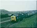
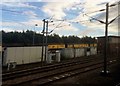

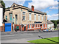
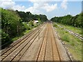
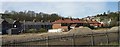
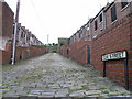
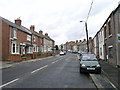
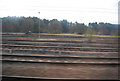
30 photos from this area
Area Information
Key information about the DL17 0AG including its size, population, and administrative classification.
- Area Type
- Postcode
- Area Size
- 1.2 hectares
- Population
- 1153
- Population Density
- 322 people/km²
House Prices in DL17 0AG
26
Properties
£55,862
Average Sold Price
£19,000
Lowest Price
£120,889
Highest Price
Showing 26 properties
| Address | Type | Beds | Baths | Last Sale Price | Last Sale Date | |
|---|---|---|---|---|---|---|
| 31 High Street, Ferryhill Station, DL17 0AG | Terraced | 2 | 1 | £39,950 | Feb 2025 | |
| 4 High Street, Ferryhill Station, DL17 0AG | Terraced | 2 | 1 | £78,999 | Mar 2024 | |
| 33 High Street, Ferryhill Station, DL17 0AG | Terraced | 1 | - | £41,000 | Apr 2022 | |
| 34 High Street, Ferryhill Station, DL17 0AG | Terraced | 2 | 2 | £120,889 | Dec 2020 | |
| 28 High Street, Ferryhill Station, DL17 0AG | Terraced | 2 | 1 | £31,000 | Apr 2020 | |
| 9 High Street, Ferryhill Station, DL17 0AG | house | - | - | £55,000 | Feb 2020 | |
| 3 High Street, Ferryhill Station, DL17 0AG | Terraced | 2 | 1 | £19,000 | Sep 2018 | |
| 30 High Street, Ferryhill Station, DL17 0AG | Flat | 2 | 1 | £57,500 | Jun 2014 | |
| 32 High Street, Ferryhill Station, DL17 0AG | Terraced | 2 | 1 | £64,000 | Aug 2007 | |
| 27 High Street, Ferryhill Station, DL17 0AG | Terraced | 2 | 1 | £60,000 | Feb 2007 |
Page 1 of 3
Energy Efficiency in DL17 0AG
Amenities
Schools
| Rank | School | Type | Entry gender | Ages |
|---|
Explore more schools in this area
Go to Schools tabDemographics
Household Size
One person
most common
Accommodation Type
Houses
most common
Tenure
45
majority
Ethnic Group
White
most common
Religion
N/A
most common
Household Composition
N/A
most common
Age
47
median
Adults (30-64 years)
most common
Household Deprivation
N/A
with no deprivation
NS-SEC
17
in Lower managerial occupations
Explore more demographic insights in this area
Go to Demographics tabPlanning
Planning Constraints
- Flood RiskPremium
- Ramsar Wetland SitesPremium
- Area of Outstanding Natural BeautyPremium
- Protected Nature ReservePremium
- Protected WoodlandPremium