Area Overview for DL16 6TA
Photos of DL16 6TA
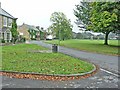
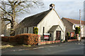
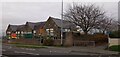
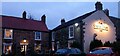
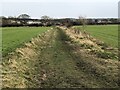
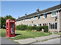
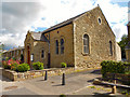
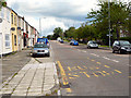

13 photos from this area
Area Information
Key information about the DL16 6TA including its size, population, and administrative classification.
- Area Type
- Postcode
- Area Size
- 2.8 hectares
- Population
- 1534
- Population Density
- 310 people/km²
House Prices in DL16 6TA
36
Properties
£67,821
Average Sold Price
£38,500
Lowest Price
£104,000
Highest Price
Showing 36 properties
| Address | Type | Beds | Baths | Last Sale Price | Last Sale Date | |
|---|---|---|---|---|---|---|
| 110 St Davids Close, Spennymoor, DL16 6TA | house | - | - | £46,000 | Jun 2019 | |
| 105 St Davids Close, Spennymoor, DL16 6TA | house | - | - | £64,950 | May 2019 | |
| 97 St Davids Close, Spennymoor, DL16 6TA | house | - | - | £68,950 | May 2019 | |
| 98 St Davids Close, Spennymoor, DL16 6TA | house | - | - | £65,000 | Jun 2018 | |
| 88 St Davids Close, Spennymoor, DL16 6TA | house | - | - | £60,000 | Aug 2017 | |
| 99 St Davids Close, Spennymoor, DL16 6TA | Detached | 3 | 1 | £92,500 | May 2017 | |
| 104 St Davids Close, Spennymoor, DL16 6TA | house | 2 | - | £59,000 | Sep 2014 | |
| 109 St Davids Close, Spennymoor, DL16 6TA | Semi-detached | 3 | - | £83,000 | Jul 2014 | |
| 86 St Davids Close, Spennymoor, DL16 6TA | Flat | - | - | £104,000 | Aug 2007 | |
| 101 St Davids Close, Spennymoor, DL16 6TA | Terraced | - | - | £91,950 | Oct 2004 |
Page 1 of 4
Energy Efficiency in DL16 6TA
Amenities
Schools
| Rank | School | Type | Entry gender | Ages |
|---|
Explore more schools in this area
Go to Schools tabDemographics
Household Size
Two person
most common
Accommodation Type
Houses
most common
Tenure
77
majority
Ethnic Group
White
most common
Religion
N/A
most common
Household Composition
N/A
most common
Age
47
median
Adults (30-64 years)
most common
Household Deprivation
N/A
with no deprivation
NS-SEC
35
in Lower managerial occupations
Explore more demographic insights in this area
Go to Demographics tabPlanning
Planning Constraints
- Flood RiskPremium
- Ramsar Wetland SitesPremium
- Area of Outstanding Natural BeautyPremium
- Protected Nature ReservePremium
- Protected WoodlandPremium