Area Overview for DL16 6NG
Photos of DL16 6NG
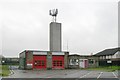
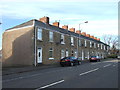
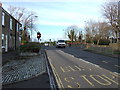

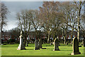
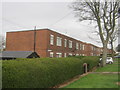
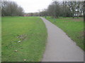

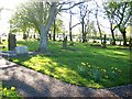
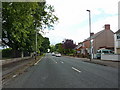
10 photos from this area
Area Information
Key information about the DL16 6NG including its size, population, and administrative classification.
- Area Type
- Postcode
- Area Size
- 1.9 hectares
- Population
- 1933
- Population Density
- 1121 people/km²
House Prices in DL16 6NG
47
Properties
£62,259
Average Sold Price
£30,950
Lowest Price
£94,950
Highest Price
Showing 47 properties
| Address | Type | Beds | Baths | Last Sale Price | Last Sale Date | |
|---|---|---|---|---|---|---|
| 103 St Andrews Road, Spennymoor, DL16 6NG | house | 2 | 1 | £92,500 | Mar 2025 | |
| 79 St Andrews Road, Spennymoor, DL16 6NG | Terraced | 3 | 2 | £51,500 | Jun 2024 | |
| 91 St Andrews Road, Spennymoor, DL16 6NG | Terraced | 3 | 1 | £70,000 | Jan 2022 | |
| 90 St Andrews Road, Spennymoor, DL16 6NG | house | 3 | - | £94,950 | Aug 2021 | |
| 70 St Andrews Road, Spennymoor, DL16 6NG | Terraced | 2 | 1 | £51,000 | Jul 2020 | |
| 76 St Andrews Road, Spennymoor, DL16 6NG | Terraced | 3 | 1 | £67,000 | Nov 2019 | |
| 92 St Andrews Road, Spennymoor, DL16 6NG | house | - | - | £53,000 | Apr 2019 | |
| 66 St Andrews Road, Spennymoor, DL16 6NG | Terraced | 2 | 1 | £75,000 | Mar 2017 | |
| 82 St Andrews Road, Spennymoor, DL16 6NG | Terraced | 2 | - | £55,000 | Jan 2014 | |
| 95 St Andrews Road, Spennymoor, DL16 6NG | house | 2 | - | £76,000 | Jul 2012 |
Page 1 of 5
Energy Efficiency in DL16 6NG
Amenities
Schools
| Rank | School | Type | Entry gender | Ages |
|---|
Explore more schools in this area
Go to Schools tabDemographics
Household Size
One person
most common
Accommodation Type
Houses
most common
Tenure
44
majority
Ethnic Group
White
most common
Religion
N/A
most common
Household Composition
N/A
most common
Age
47
median
Adults (30-64 years)
most common
Household Deprivation
N/A
with no deprivation
NS-SEC
24
in Lower managerial occupations
Explore more demographic insights in this area
Go to Demographics tabPlanning
Planning Constraints
- Flood RiskPremium
- Ramsar Wetland SitesPremium
- Area of Outstanding Natural BeautyPremium
- Protected Nature ReservePremium
- Protected WoodlandPremium