Area Overview for DL16 6HT
Photos of DL16 6HT
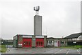
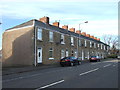
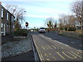
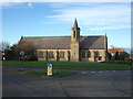
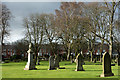
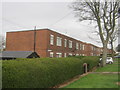
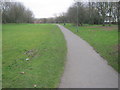
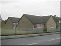
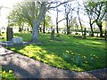
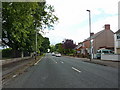
10 photos from this area
Area Information
Key information about the DL16 6HT including its size, population, and administrative classification.
- Area Type
- Postcode
- Area Size
- 7214 m²
- Population
- 1909
- Population Density
- 2874 people/km²
House Prices in DL16 6HT
30
Properties
£51,820
Average Sold Price
£27,250
Lowest Price
£67,500
Highest Price
Showing 30 properties
| Address | Type | Beds | Baths | Last Sale Price | Last Sale Date | |
|---|---|---|---|---|---|---|
| 8 Upper Church Street, Spennymoor, DL16 6HT | house | 2 | - | £60,000 | Sep 2021 | |
| 20 Upper Church Street, Spennymoor, DL16 6HT | Terraced | 2 | 1 | £67,500 | May 2021 | |
| 23 Upper Church Street, Spennymoor, DL16 6HT | house | - | - | £30,000 | Mar 2020 | |
| 25 Upper Church Street, Spennymoor, DL16 6HT | house | - | - | £55,000 | Jun 2019 | |
| 21 Upper Church Street, Spennymoor, DL16 6HT | house | - | - | £52,000 | May 2017 | |
| 7 Upper Church Street, Spennymoor, DL16 6HT | Terraced | 2 | - | £65,000 | Nov 2013 | |
| 12 Upper Church Street, Spennymoor, DL16 6HT | house | - | - | £67,500 | Jun 2009 | |
| 3 Upper Church Street, Spennymoor, DL16 6HT | house | 2 | 1 | £66,000 | Dec 2007 | |
| 14 Upper Church Street, Spennymoor, DL16 6HT | Terraced | - | - | £27,250 | Dec 2003 | |
| 11 Upper Church Street, Spennymoor, DL16 6HT | Semi-detached | - | - | £27,950 | Jun 2001 |
Page 1 of 3
Energy Efficiency in DL16 6HT
Amenities
Schools
| Rank | School | Type | Entry gender | Ages |
|---|
Explore more schools in this area
Go to Schools tabDemographics
Household Size
One person
most common
Accommodation Type
Houses
most common
Tenure
43
majority
Ethnic Group
White
most common
Religion
N/A
most common
Household Composition
N/A
most common
Age
47
median
Adults (30-64 years)
most common
Household Deprivation
N/A
with no deprivation
NS-SEC
17
in Lower managerial occupations
Explore more demographic insights in this area
Go to Demographics tabPlanning
Planning Constraints
- Flood RiskPremium
- Ramsar Wetland SitesPremium
- Area of Outstanding Natural BeautyPremium
- Protected Nature ReservePremium
- Protected WoodlandPremium