Area Overview for DL15 9UB
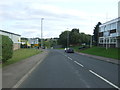
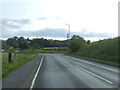
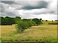
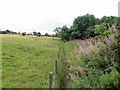
Photos of DL15 9UB


Area Information
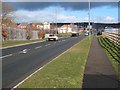
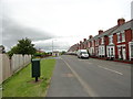
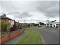
DL15 9UB is a compact residential postcode in England, home to 2,178 people spread across a densely populated area of 1.2 km². This small cluster of homes reflects a settled community, with a median age of 47 and a majority of residents aged 30–64. The area is characterised by its focus on owner-occupied housing, with 81% of properties in private ownership. Daily life here is shaped by proximity to local amenities and a quiet, suburban feel. While the population density is high, the area lacks large-scale commercial or industrial development, creating a neighbourhood that prioritises residential comfort. Its location near Bishop Auckland and surrounding villages offers access to broader services while maintaining a localised, tight-knit community. The absence of major planning constraints, such as protected landscapes or wetlands, means development is unencumbered, though this also means the area has not seen recent expansion. For those seeking a stable, family-oriented environment with a focus on home ownership, DL15 9UB presents a straightforward, low-maintenance living option.
- Area Type
- Postcode
- Area Size
- Not available
- Population
- 2178
- Population Density
- 1779 people/km²
DL15 9UB is predominantly an owner-occupied area, with 81% of properties in private hands. This contrasts with rental markets where landlords dominate, suggesting a community of long-term residents invested in their homes. The accommodation type is primarily houses, which is unusual for areas with high population density. This mix of high ownership and single-family homes indicates a market where properties are likely to be family homes, offering more space than typical urban dwellings. For buyers, this means a limited but focused selection of properties, with fewer apartments or shared housing options. The small size of the postcode means the housing stock is concentrated, and buyers may need to look beyond DL15 9UB itself for additional choices. The lack of planning constraints, such as protected areas or flood risks, also suggests that property values are not unduly affected by external factors, making it a straightforward market for those seeking a stable, low-risk investment.
House Prices in DL15 9UB
No properties found in this postcode.
Energy Efficiency in DL15 9UB
Residents of DL15 9UB have access to a range of nearby amenities, including five retail outlets such as Lidl Crook, Aldi Queen, and Heron Crook. These shops provide essential groceries and daily necessities, reducing the need for long trips to larger centres. The three nearby railway stations offer convenient transport links to Bishop Auckland and surrounding areas, supporting both commuting and leisure travel. While the area lacks large parks or entertainment venues, the compact size of DL15 9UB means residents can reach these services quickly. The presence of local shops and rail access contributes to a self-contained lifestyle, ideal for those who prefer proximity to essentials without the hustle of a busy town centre. The character of the area is defined by its practicality, with amenities focused on functionality rather than luxury, making it suitable for families and individuals prioritising convenience over sprawling leisure options.
Amenities
Schools
DL15 9UB is served by a range of primary and nursery schools, including Crook Nursery School, Crook Primary School (rated 'good' by Ofsted), and Crook Infant School. These institutions cater to young children, with the primary school offering a solid foundation for education. The presence of both infant and primary schools ensures continuity for families with children of different ages. The 'good' Ofsted rating at Crook Primary School indicates a school that meets or exceeds national standards in teaching quality and student outcomes. For families prioritising education, this cluster of schools provides a comprehensive early-years and primary education network. However, the absence of secondary schools in the immediate area means students may need to travel to nearby towns for further education. The school mix reflects a community that values local education but relies on broader regional infrastructure for higher-level schooling.
| Rank | School | Type | Entry gender | Ages |
|---|
Explore more schools in this area
Go to Schools tabDemographics
The population of DL15 9UB is predominantly composed of adults aged 30–64, with a median age of 47. This suggests a mature, established community with a strong presence of middle-aged residents. Home ownership is high at 81%, indicating a stable housing market where most properties are privately held. The area is dominated by houses rather than flats, reflecting a preference for single-family dwellings. The predominant ethnic group is White, though specific data on diversity or minority representation is not provided. The high proportion of owner-occupied homes and the age profile suggest a community with long-term residency and limited turnover. With no data on deprivation levels, it is unclear how economic pressures might affect quality of life, but the low crime risk and absence of environmental constraints imply a generally secure and accessible environment for residents.
Household Size
Accommodation Type
Tenure
Ethnic Group
Religion
Household Composition
Age
Household Deprivation
NS-SEC
Explore more demographic insights in this area
Go to Demographics tabPlanning
Planning Constraints
- Flood RiskPremium
- Ramsar Wetland SitesPremium
- Area of Outstanding Natural BeautyPremium
- Protected Nature ReservePremium
- Protected WoodlandPremium