Area Overview for DL15 9PR
Photos of DL15 9PR
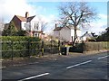
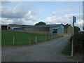
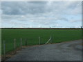
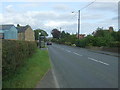
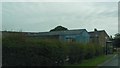
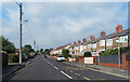
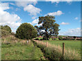
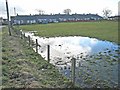


10 photos from this area
Area Information
Key information about the DL15 9PR including its size, population, and administrative classification.
- Area Type
- Postcode
- Area Size
- 6949 m²
- Population
- 2178
- Population Density
- 1779 people/km²
House Prices in DL15 9PR
21
Properties
£53,773
Average Sold Price
£22,950
Lowest Price
£86,000
Highest Price
Showing 21 properties
| Address | Type | Beds | Baths | Last Sale Price | Last Sale Date | |
|---|---|---|---|---|---|---|
| 1 Thistleflat Road, Crook, DL15 9PR | Flat | 2 | 1 | £64,500 | Oct 2024 | |
| 21 Thistleflat Road, Crook, DL15 9PR | Flat | 2 | 1 | £63,000 | Dec 2023 | |
| 27 Thistleflat Road, Crook, DL15 9PR | Terraced | 2 | 1 | £86,000 | Jun 2020 | |
| 5 Thistleflat Road, Crook, DL15 9PR | Flat | - | - | £35,000 | Dec 2019 | |
| 3 Thistleflat Road, Crook, DL15 9PR | Flat | - | - | £50,000 | Jan 2019 | |
| 11 Thistleflat Road, Crook, DL15 9PR | Flat | - | - | £36,000 | May 2017 | |
| 23 Thistleflat Road, Crook, DL15 9PR | Flat | - | - | £60,000 | Sep 2015 | |
| 9 Thistleflat Road, Crook, DL15 9PR | Flat | - | - | £55,000 | Feb 2015 | |
| 35 Thistleflat Road, Crook, DL15 9PR | house | 3 | 1 | £78,000 | Jan 2015 | |
| 41 Thistleflat Road, Crook, DL15 9PR | house | - | - | £75,100 | May 2005 |
Page 1 of 3
Energy Efficiency in DL15 9PR
Amenities
Schools
| Rank | School | Type | Entry gender | Ages |
|---|
Explore more schools in this area
Go to Schools tabDemographics
Household Size
Two person
most common
Accommodation Type
Houses
most common
Tenure
81
majority
Ethnic Group
White
most common
Religion
N/A
most common
Household Composition
N/A
most common
Age
47
median
Adults (30-64 years)
most common
Household Deprivation
N/A
with no deprivation
NS-SEC
32
in Lower managerial occupations
Explore more demographic insights in this area
Go to Demographics tabPlanning
Planning Constraints
- Flood RiskPremium
- Ramsar Wetland SitesPremium
- Area of Outstanding Natural BeautyPremium
- Protected Nature ReservePremium
- Protected WoodlandPremium