Area Overview for DL15 9AJ
Photos of DL15 9AJ
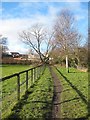
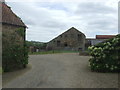

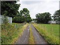
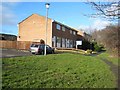
5 photos from this area
Area Information
Key information about the DL15 9AJ including its size, population, and administrative classification.
- Area Type
- Postcode
- Area Size
- 1.9 hectares
- Population
- 2178
- Population Density
- 1779 people/km²
House Prices in DL15 9AJ
49
Properties
£189,918
Average Sold Price
£135,625
Lowest Price
£285,000
Highest Price
Showing 49 properties
| Address | Type | Beds | Baths | Last Sale Price | Last Sale Date | |
|---|---|---|---|---|---|---|
| 24 Kipling Way, Crook, DL15 9AJ | Detached | 3 | 2 | £185,000 | Sep 2025 | |
| 40 Kipling Way, Crook, DL15 9AJ | Detached | 3 | 2 | £195,000 | Aug 2025 | |
| 49 Kipling Way, Crook, DL15 9AJ | house | - | - | £285,000 | Mar 2025 | |
| 34 Kipling Way, Crook, DL15 9AJ | house | - | - | £275,000 | Dec 2024 | |
| 27 Kipling Way, Crook, DL15 9AJ | house | - | - | £280,000 | Apr 2024 | |
| 5 Kipling Way, Crook, DL15 9AJ | Detached | 4 | 2 | £279,950 | Nov 2023 | |
| 28 Kipling Way, Crook, DL15 9AJ | house | 4 | 2 | £232,000 | Nov 2022 | |
| 37 Kipling Way, Crook, DL15 9AJ | Detached | 3 | 2 | £190,000 | Sep 2022 | |
| 22 Kipling Way, Crook, DL15 9AJ | house | 4 | 3 | £235,000 | Sep 2022 | |
| 45 Kipling Way, Crook, DL15 9AJ | house | - | - | £215,000 | Nov 2021 |
Page 1 of 5
Energy Efficiency in DL15 9AJ
Amenities
Schools
| Rank | School | Type | Entry gender | Ages |
|---|
Explore more schools in this area
Go to Schools tabDemographics
Household Size
Two person
most common
Accommodation Type
Houses
most common
Tenure
81
majority
Ethnic Group
White
most common
Religion
N/A
most common
Household Composition
N/A
most common
Age
47
median
Adults (30-64 years)
most common
Household Deprivation
N/A
with no deprivation
NS-SEC
32
in Lower managerial occupations
Explore more demographic insights in this area
Go to Demographics tabPlanning
Planning Constraints
- Flood RiskPremium
- Ramsar Wetland SitesPremium
- Area of Outstanding Natural BeautyPremium
- Protected Nature ReservePremium
- Protected WoodlandPremium