Area Overview for DL15 0GB
Photos of DL15 0GB
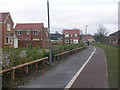
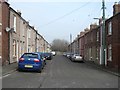
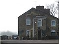

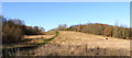
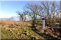
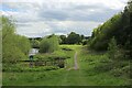
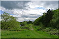
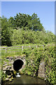
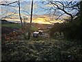
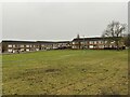
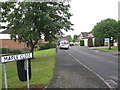
20 photos from this area
Area Information
Key information about the DL15 0GB including its size, population, and administrative classification.
- Area Type
- Postcode
- Area Size
- 4.3 hectares
- Population
- 1749
- Population Density
- 585 people/km²
House Prices in DL15 0GB
75
Properties
£139,869
Average Sold Price
£72,450
Lowest Price
£255,000
Highest Price
Showing 75 properties
| Address | Type | Beds | Baths | Last Sale Price | Last Sale Date | |
|---|---|---|---|---|---|---|
| 64 Armstrong Drive, Willington, DL15 0GB | Detached | 3 | 2 | £147,000 | Nov 2025 | |
| 48A Armstrong Drive, Willington, DL15 0GB | Semi-detached | 3 | 2 | £151,000 | Mar 2025 | |
| 14 Armstrong Drive, Willington, DL15 0GB | house | 3 | - | £195,000 | Nov 2024 | |
| 67 Armstrong Drive, Willington, DL15 0GB | Semi-detached | 3 | 2 | £130,000 | Sep 2024 | |
| 15 Armstrong Drive, Willington, DL15 0GB | Detached | 4 | 2 | £190,000 | Sep 2024 | |
| 55 Armstrong Drive, Willington, DL15 0GB | Detached | 4 | 3 | £255,000 | Feb 2024 | |
| 6 Armstrong Drive, Willington, DL15 0GB | Detached | 3 | - | £145,000 | Feb 2024 | |
| 19 Armstrong Drive, Willington, DL15 0GB | house | - | - | £140,000 | Aug 2023 | |
| 53 Armstrong Drive, Willington, DL15 0GB | Semi-detached | 3 | 3 | £165,000 | May 2023 | |
| 54 Armstrong Drive, Willington, DL15 0GB | house | - | - | £140,000 | Feb 2023 |
Page 1 of 8
Energy Efficiency in DL15 0GB
Amenities
Schools
| Rank | School | Type | Entry gender | Ages |
|---|
Explore more schools in this area
Go to Schools tabDemographics
Household Size
Two person
most common
Accommodation Type
Houses
most common
Tenure
68
majority
Ethnic Group
White
most common
Religion
N/A
most common
Household Composition
N/A
most common
Age
47
median
Adults (30-64 years)
most common
Household Deprivation
N/A
with no deprivation
NS-SEC
30
in Lower managerial occupations
Explore more demographic insights in this area
Go to Demographics tabPlanning
Planning Constraints
- Flood RiskPremium
- Ramsar Wetland SitesPremium
- Area of Outstanding Natural BeautyPremium
- Protected Nature ReservePremium
- Protected WoodlandPremium