Area Overview for DL14 9AA
Photos of DL14 9AA

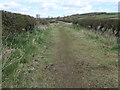
![River Gaunless at Fylands Bridge [A6072] in DL14 9AA](https://images.propbar.co.uk/images/geograph/61/18/6118665_120.jpg)
37 photos from this area
Area Information
Key information about the DL14 9AA including its size, population, and administrative classification.
- Area Type
- Postcode
- Area Size
- 26.4 hectares
- Population
- 1711
- Population Density
- 515 people/km²
House Prices in DL14 9AA
9
Properties
-
Average Sold Price
-
Lowest Price
-
Highest Price
Showing 9 properties
Energy Efficiency in DL14 9AA
Amenities
Schools
| Rank | School | Type | Entry gender | Ages |
|---|
Explore more schools in this area
Go to Schools tabDemographics
Household Size
Family (3-5 people)
most common
Accommodation Type
Houses
most common
Tenure
70
majority
Ethnic Group
White
most common
Religion
N/A
most common
Household Composition
N/A
most common
Age
47
median
Adults (30-64 years)
most common
Household Deprivation
N/A
with no deprivation
NS-SEC
26
in Lower managerial occupations
Explore more demographic insights in this area
Go to Demographics tabPlanning
Planning Constraints
- Flood RiskPremium
- Ramsar Wetland SitesPremium
- Area of Outstanding Natural BeautyPremium
- Protected Nature ReservePremium
- Protected WoodlandPremium