Area Overview for DL14 8BF
Photos of DL14 8BF

Area Information
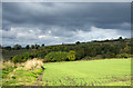
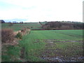
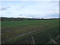
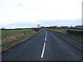
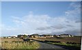
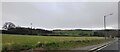
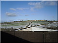
Living in DL14 8BF means being part of a small, tightly knit residential cluster in England. The area spans just 2.7 hectares and is home to 1,365 residents, giving it a population density of 118 people per square kilometre. This compact postcode is characterised by a mature community, with a median age of 47 and a majority of residents aged between 30 and 64. The area’s housing stock is predominantly owner-occupied, with 72% of homes owned by residents rather than rented. This suggests a stable, long-term presence of households. Daily life here is shaped by proximity to local amenities and transport links. While the area itself is small, its strategic placement near key rail stations and retail hubs ensures residents have access to broader services. The absence of environmental constraints like protected woodlands or wetlands means development is not restricted, though the area’s modest size means housing options are limited to a handful of properties. For those seeking a quiet, established community with practical connectivity, DL14 8BF offers a blend of simplicity and accessibility.
- Area Type
- Postcode
- Area Size
- 2.7 hectares
- Population
- 1365
- Population Density
- 118 people/km²
The property market in DL14 8BF is dominated by owner-occupied homes, with 72% of properties owned by residents. This high rate of home ownership points to a community where long-term residency is the norm, rather than a rental market. The accommodation type is predominantly houses, which aligns with the area’s character as a small, residential cluster. Given the postcode’s limited size—just 2.7 hectares—the housing stock is necessarily constrained, with only a handful of properties available. This scarcity means buyers must consider nearby areas for more options, though the immediate vicinity may offer limited scope for expansion. The focus on houses rather than flats suggests a preference for family-friendly or spacious living, which may appeal to those seeking a traditional, settled lifestyle. For prospective buyers, the market here is likely to be competitive, with properties holding value due to their rarity and the area’s practical connectivity to transport and amenities.
House Prices in DL14 8BF
Showing 1 properties
| Address | Type | Beds | Baths | Last Sale Price | Last Sale Date | |
|---|---|---|---|---|---|---|
| Eastfield, Unc 42.12 From A 688 Junc To B 6287 Junc, New Coundon, DL14 8BF | Bungalow | - | - | - | - |
Energy Efficiency in DL14 8BF
Residents of DL14 8BF have access to a range of nearby amenities that support both daily needs and leisure. The area’s retail offerings include five notable venues, such as Sainsburys Coundon and Spar Parkhead, providing convenience for grocery shopping and everyday essentials. For dining and socialising, Heron Toronto adds a local option. While the area itself is small, its proximity to rail stations like Bishop Auckland and Shildon opens up broader opportunities for travel, whether for work, shopping, or cultural activities. The absence of nearby parks or green spaces means outdoor recreation may require a trip to a larger town, but the compact layout ensures that essential services are within walking or short driving distance. The combination of retail convenience and rail connectivity creates a lifestyle that prioritises practicality without sacrificing access to regional hubs.
Amenities
Schools
| Rank | School | Type | Entry gender | Ages |
|---|
Explore more schools in this area
Go to Schools tabDemographics
The community in DL14 8BF is predominantly composed of adults aged 30 to 64, with a median age of 47. This suggests a population skewed towards middle-aged individuals, likely settled in long-term homes. Home ownership is high, with 72% of residents owning their properties, indicating a stable demographic with little turnover. The area’s accommodation is largely made up of houses, reflecting a preference for single-family dwellings over flats or apartments. The predominant ethnic group is White, though no specific data on diversity or deprivation is provided. The absence of detailed diversity metrics means the community’s composition remains largely unquantified beyond this. The age profile and home ownership rate suggest a population that is neither young nor transient, with a focus on established households. This stability may contribute to a cohesive local environment, though the small population size means social networks are likely tight-knit.
Household Size
Accommodation Type
Tenure
Ethnic Group
Religion
Household Composition
Age
Household Deprivation
NS-SEC
Explore more demographic insights in this area
Go to Demographics tabPlanning
Planning Constraints
- Flood RiskPremium
- Ramsar Wetland SitesPremium
- Area of Outstanding Natural BeautyPremium
- Protected Nature ReservePremium
- Protected WoodlandPremium