Area Overview for DL14 7TF
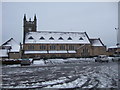
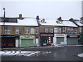
Photos of DL14 7TF


Area Information
Living in DL14 7TF means inhabiting a tightly packed residential cluster in England, where 1,734 people reside across just 1,499 square metres. This small area, though densely populated, offers a compact living environment with immediate access to essential services. The proximity to Bishop Auckland Railway Station and nearby retail hubs like Morrisons Toronto and Asda Bishop ensures daily conveniences are within reach. The area’s demographic profile suggests a mature community, with a median age of 47 and a strong presence of adults aged 30–64. While the high population density may feel intimate, it also reflects the area’s role as a focused residential hub rather than a sprawling suburb. For those seeking a quiet, localised lifestyle, DL14 7TF provides a mix of practicality and proximity to transport links, though its size means amenities are limited to nearby towns. The presence of Etherley Lane Primary School, rated good by Ofsted, adds a layer of appeal for families. This postcode is not for those seeking expansive space, but it suits those prioritising accessibility and a close-knit community.
- Area Type
- Postcode
- Area Size
- 1499 m²
- Population
- 1734
- Population Density
- 2332 people/km²
DL14 7TF is primarily an owner-occupied area, with 64% of residents living in their own homes. The accommodation type is exclusively houses, indicating a market focused on standalone properties rather than flats or apartments. This makes the area attractive to buyers seeking traditional homes, but it also means the property stock is limited, given the small size of the postcode. The high population density—over a million people per square kilometre—suggests that the available houses are likely to be in high demand, potentially driving up prices in the immediate vicinity. For buyers, this means competition may be fierce, and the need for nearby alternatives is crucial. The lack of rental properties also implies that the area is less suited to investors seeking long-term lettings. Those considering DL14 7TF should focus on securing a home quickly, as the market’s compact nature may offer limited options once properties are sold.
House Prices in DL14 7TF
Showing 12 properties
| Address | Type | Beds | Baths | Last Sale Price | Last Sale Date | |
|---|---|---|---|---|---|---|
| 10 Eden Court, Bishop Auckland, DL14 7TF | Flat | - | - | - | - | |
| 7 Eden Court, Bishop Auckland, DL14 7TF | Flat | - | - | - | - | |
| 5 Eden Court, Bishop Auckland, DL14 7TF | Flat | - | - | - | - | |
| 6 Eden Court, Bishop Auckland, DL14 7TF | Flat | - | - | - | - | |
| 2 Eden Court, Bishop Auckland, DL14 7TF | Flat | - | - | - | - | |
| 3 Eden Court, Bishop Auckland, DL14 7TF | Flat | - | - | - | - | |
| 11 Eden Court, Bishop Auckland, DL14 7TF | Flat | - | - | - | - | |
| 4 Eden Court, Bishop Auckland, DL14 7TF | Flat | - | - | - | - | |
| 8 Eden Court, Bishop Auckland, DL14 7TF | Flat | - | - | - | - | |
| 9 Eden Court, Bishop Auckland, DL14 7TF | Flat | - | - | - | - |
Energy Efficiency in DL14 7TF
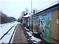
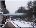
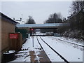
Daily life in DL14 7TF revolves around its immediate surroundings, with five retail outlets nearby, including Morrisons Toronto and Asda Bishop, offering grocery and shopping needs. The area’s rail network, with stations like Bishop Auckland and Shildon, provides easy access to broader regional amenities. While the postcode itself lacks extensive parks or leisure facilities, its proximity to Bishop Auckland likely means residents can enjoy nearby green spaces and recreational opportunities. The compact nature of DL14 7TF fosters a convenience-driven lifestyle, where essential services are close but the need for travel to larger towns is inevitable. For those prioritising ease of access over expansive local amenities, this balance of proximity and practicality may be appealing. However, the absence of on-site parks or entertainment venues means the area’s lifestyle is best suited to those who regularly venture to nearby towns for leisure.
Amenities
Schools
DL14 7TF is served by two educational institutions: Etherley Lane Nursery School and Etherley Lane Primary School. The primary school, rated good by Ofsted, provides a solid foundation for young learners, though the absence of secondary schools nearby means families may need to look further afield for high school options. The presence of a nursery and primary school within the area supports early education needs, making it a viable choice for families with young children. However, the lack of higher education facilities within the postcode itself could be a drawback for those requiring a full range of schooling options. For parents prioritising local schools, the primary’s good rating is a positive, but the need for additional planning for secondary education should be factored into any decision to move.
| Rank | School | Type | Entry gender | Ages |
|---|
Explore more schools in this area
Go to Schools tabDemographics
DL14 7TF’s population skews towards adults aged 30–64, with a median age of 47. This suggests a community of established professionals and families, rather than a younger or elderly demographic. Home ownership is strong here, with 64% of residents living in their own homes, compared to 36% renting. The accommodation type is predominantly houses, reflecting a preference for standalone properties over flats. The predominant ethnic group is White, with no data indicating significant diversity beyond this. The high population density—1,157,057 people per square kilometre—means the area is intensely populated for its size, which could impact privacy and space. While this density may raise concerns about overcrowding, it also implies a high level of social interaction and community cohesion. For buyers, this suggests a market skewed toward owner-occupiers seeking homes in a compact, established area, though the lack of rental properties may limit options for those needing flexibility.
Household Size
Accommodation Type
Tenure
Ethnic Group
Religion
Household Composition
Age
Household Deprivation
NS-SEC
Explore more demographic insights in this area
Go to Demographics tabPlanning
Planning Constraints
- Flood RiskPremium
- Ramsar Wetland SitesPremium
- Area of Outstanding Natural BeautyPremium
- Protected Nature ReservePremium
- Protected WoodlandPremium