Area Overview for DL14 7RB
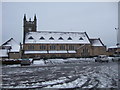
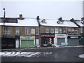
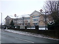
Photos of DL14 7RB

Area Information
DL14 7RB is a compact residential postcode in England, covering just 1.8 hectares and home to 1,734 people. Its small size means it is a tightly knit community, with a population density of 96,912 people per square kilometre. This area is characterised by its focus on housing, with 64% of residents owning their homes. The demographic profile shows a mature population, with a median age of 47 and the majority of residents falling within the 30-64 age range. Daily life here is shaped by proximity to local amenities, including shops, rail links, and schools. The area’s limited size means it is ideal for those seeking a quiet, established neighbourhood with easy access to essential services. While it lacks the sprawling infrastructure of larger towns, its compact nature fosters a close-knit community feel. Residents benefit from nearby retail options and multiple railway stations, making it convenient for commuters. The area’s small footprint also means it is unlikely to undergo significant development, preserving its existing character. For buyers, this presents a chance to own property in a stable, low-flood-risk environment, though the high crime risk nearby requires attention.
- Area Type
- Postcode
- Area Size
- 1.8 hectares
- Population
- 1734
- Population Density
- 96912 people/km²
DL14 7RB is a predominantly owner-occupied area, with 64% of residents owning their homes. This suggests a stable property market where long-term investment is common. The accommodation type is primarily houses, which are more prevalent than flats or apartments in this small postcode. The limited area size means the housing stock is concentrated, with no indication of large-scale developments or rental properties dominating the market. For buyers, this presents a niche opportunity to purchase in a compact, established neighbourhood where property values may be influenced by proximity to local amenities and transport links. The high home ownership rate also implies that the area is less likely to experience rapid price fluctuations. However, the small size of DL14 7RB means that the property market is not expansive, and buyers may need to consider nearby areas for more options. The focus on houses suggests that the area appeals to families or individuals seeking traditional, private living spaces rather than high-density housing.
House Prices in DL14 7RB
Showing 22 properties
| Address | Type | Beds | Baths | Last Sale Price | Last Sale Date | |
|---|---|---|---|---|---|---|
| 14 Clarence Gardens, Bishop Auckland, DL14 7RB | house | - | - | £165,000 | Jul 2022 | |
| 22 Clarence Gardens, Bishop Auckland, DL14 7RB | Semi-detached | 3 | 1 | £200,000 | Mar 2021 | |
| 13 Clarence Gardens, Bishop Auckland, DL14 7RB | house | - | - | £190,000 | Dec 2019 | |
| 11 Clarence Gardens, Bishop Auckland, DL14 7RB | Semi-detached | 3 | 1 | £186,000 | May 2018 | |
| 9 Clarence Gardens, Bishop Auckland, DL14 7RB | Semi-detached | 3 | 1 | £168,000 | Feb 2016 | |
| 15 Clarence Gardens, Bishop Auckland, DL14 7RB | house | - | - | £150,000 | Jan 2012 | |
| 8 Clarence Gardens, Bishop Auckland, DL14 7RB | Bungalow | - | - | £165,000 | Jan 2009 | |
| 5 Clarence Gardens, Bishop Auckland, DL14 7RB | house | 3 | - | £160,000 | Aug 2008 | |
| 6 Clarence Gardens, Bishop Auckland, DL14 7RB | Terraced | - | - | £148,000 | Jul 2007 | |
| 10 Clarence Gardens, Bishop Auckland, DL14 7RB | Terraced | 3 | 1 | £134,950 | Feb 2004 |
Energy Efficiency in DL14 7RB
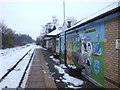
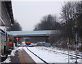
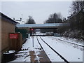
The lifestyle in DL14 7RB is shaped by its proximity to retail and transport hubs. Nearby shops include Morrisons Toronto, Heron Toronto, and Asda Bishop, providing a range of shopping options within practical reach. These stores cater to everyday needs, from groceries to household items, reducing the necessity for long trips to larger centres. The area also has multiple railway stations, including Bishop Auckland and Shildon, which connect residents to broader regional networks. While the data does not mention parks or leisure facilities, the presence of retail and transport options suggests a practical, service-oriented lifestyle. The compact nature of the area means that amenities are closely clustered, fostering convenience and accessibility. For residents, this balance of retail, transport, and community services creates a functional living environment, ideal for those prioritising ease of access over expansive recreational spaces.
Amenities
Schools
DL14 7RB is served by two schools: Etherley Lane Nursery School and Etherley Lane Primary School. The primary school has an Ofsted rating of ‘good’, indicating a satisfactory standard of education. The presence of both a nursery and primary school within the area provides convenience for families with young children, reducing the need for long commutes to education. However, the data does not include secondary schools, which may require residents to travel to nearby towns for further education. The ‘good’ rating at the primary school suggests that it meets national standards, though it does not indicate excellence. For families prioritising proximity to schools, this area offers a practical solution, but those seeking a broader range of educational options may need to look beyond DL14 7RB. The mix of nursery and primary schools reflects the community’s focus on early education and family needs.
| Rank | School | Type | Entry gender | Ages |
|---|
Explore more schools in this area
Go to Schools tabDemographics
The community in DL14 7RB is predominantly composed of adults aged 30-64, with a median age of 47. This suggests a population that is largely settled, with few young families or retirees. Home ownership is strong, at 64%, indicating a stable housing market where most residents are long-term occupants. The area is largely made up of houses rather than flats, reflecting a preference for traditional family homes. The predominant ethnic group is White, which aligns with broader trends in the region. With a population density of 96,912 people per square kilometre, the area is highly compact, which may influence the pace of life and the availability of private space. This density also means that local amenities are closely clustered, reducing the need for long commutes. However, the high concentration of people in a small area could impact the availability of green spaces or recreational facilities. The demographic profile suggests a community that values stability and proximity to services, with a focus on family-oriented living.
Household Size
Accommodation Type
Tenure
Ethnic Group
Religion
Household Composition
Age
Household Deprivation
NS-SEC
Explore more demographic insights in this area
Go to Demographics tabPlanning
Planning Constraints
- Flood RiskPremium
- Ramsar Wetland SitesPremium
- Area of Outstanding Natural BeautyPremium
- Protected Nature ReservePremium
- Protected WoodlandPremium