Area Overview for DL13 5AR
Photos of DL13 5AR
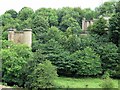
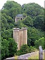
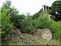
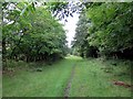
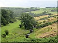
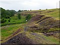
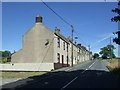
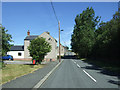
31 photos from this area
Area Information
Key information about the DL13 5AR including its size, population, and administrative classification.
- Area Type
- Postcode
- Area Size
- 20.6 hectares
- Population
- 1146
- Population Density
- 61 people/km²
House Prices in DL13 5AR
22
Properties
£121,758
Average Sold Price
£23,000
Lowest Price
£290,000
Highest Price
Showing 22 properties
| Address | Type | Beds | Baths | Last Sale Price | Last Sale Date | |
|---|---|---|---|---|---|---|
| 9 High Lands, Cockfield, DL13 5AR | house | - | - | £242,500 | Oct 2025 | |
| 33 High Lands, Cockfield, DL13 5AR | Terraced | 2 | 1 | £142,500 | Aug 2024 | |
| 29 High Lands, Cockfield, DL13 5AR | house | 2 | 1 | £105,100 | Apr 2021 | |
| Holston House, High Lands, Cockfield, DL13 5AR | house | - | - | £170,000 | Jan 2018 | |
| Chapel Lodge, High Lands, Cockfield, DL13 5AR | Detached | 3 | 1 | £148,000 | Apr 2017 | |
| 28 High Lands, Cockfield, DL13 5AR | Terraced | 2 | - | £90,000 | Jul 2015 | |
| 30 High Lands, Cockfield, DL13 5AR | Terraced | 2 | 1 | £105,000 | Jul 2008 | |
| 27 High Lands, Cockfield, DL13 5AR | house | - | - | £75,500 | Nov 2006 | |
| Sunnycrest, High Lands, Cockfield, DL13 5AR | Detached | - | - | £290,000 | Nov 2004 | |
| 34 High Lands, Cockfield, DL13 5AR | Terraced | - | - | £23,000 | Oct 2000 |
Page 1 of 3
Energy Efficiency in DL13 5AR
Amenities
Schools
| Rank | School | Type | Entry gender | Ages |
|---|
Explore more schools in this area
Go to Schools tabDemographics
Household Size
Two person
most common
Accommodation Type
Houses
most common
Tenure
75
majority
Ethnic Group
White
most common
Religion
N/A
most common
Household Composition
N/A
most common
Age
47
median
Adults (30-64 years)
most common
Household Deprivation
N/A
with no deprivation
NS-SEC
21
in Lower managerial occupations
Explore more demographic insights in this area
Go to Demographics tabPlanning
Planning Constraints
- Flood RiskPremium
- Ramsar Wetland SitesPremium
- Area of Outstanding Natural BeautyPremium
- Protected Nature ReservePremium
- Protected WoodlandPremium