Area Overview for DL13 2PE
Photos of DL13 2PE
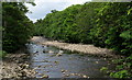
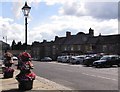
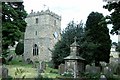
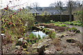
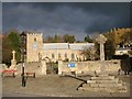
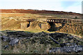
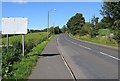
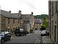
100 photos from this area
Area Information
Key information about the DL13 2PE including its size, population, and administrative classification.
- Area Type
- Postcode
- Area Size
- 1.2 hectares
- Population
- 1672
- Population Density
- 46 people/km²
House Prices in DL13 2PE
22
Properties
£152,273
Average Sold Price
£69,000
Lowest Price
£275,000
Highest Price
Showing 22 properties
| Address | Type | Beds | Baths | Last Sale Price | Last Sale Date | |
|---|---|---|---|---|---|---|
| 15 Rose Terrace, Stanhope, DL13 2PE | Terraced | 3 | 2 | £229,950 | Oct 2023 | |
| Burnside, 23 Rose Terrace, Stanhope, DL13 2PE | Semi-detached | 6 | 5 | £275,000 | May 2021 | |
| West View, 21 Rose Terrace, Stanhope, DL13 2PE | Detached | 4 | - | £225,000 | Aug 2019 | |
| 12 Rose Terrace, Stanhope, DL13 2PE | Terraced | 2 | 2 | £137,500 | Dec 2018 | |
| 8 Rose Terrace, Stanhope, DL13 2PE | house | - | - | £110,000 | Feb 2016 | |
| 5 Rose Terrace, Stanhope, DL13 2PE | Terraced | 2 | - | £69,000 | May 2015 | |
| 19 Rose Terrace, Stanhope, DL13 2PE | house | - | - | £112,500 | Jan 2014 | |
| 20 Rose Terrace, Stanhope, DL13 2PE | house | 2 | 1 | £85,000 | Dec 2013 | |
| 11 Rose Terrace, Stanhope, DL13 2PE | Terraced | 3 | - | £127,600 | Mar 2012 | |
| 18 Rose Terrace, Stanhope, DL13 2PE | house | - | - | £120,000 | Jan 2006 |
Page 1 of 3
Energy Efficiency in DL13 2PE
Amenities
Schools
| Rank | School | Type | Entry gender | Ages |
|---|
Explore more schools in this area
Go to Schools tabDemographics
Household Size
Two person
most common
Accommodation Type
Houses
most common
Tenure
67
majority
Ethnic Group
White
most common
Religion
N/A
most common
Household Composition
N/A
most common
Age
47
median
Adults (30-64 years)
most common
Household Deprivation
N/A
with no deprivation
NS-SEC
30
in Lower managerial occupations
Explore more demographic insights in this area
Go to Demographics tabPlanning
Planning Constraints
- Flood RiskPremium
- Ramsar Wetland SitesPremium
- Area of Outstanding Natural BeautyPremium
- Protected Nature ReservePremium
- Protected WoodlandPremium