Area Overview for DL13 1YZ
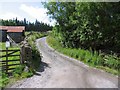
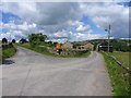
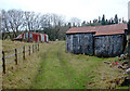
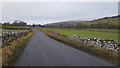
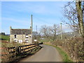
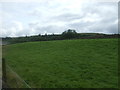
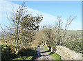
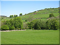
Photos of DL13 1YZ
Area Information
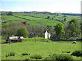
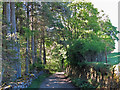
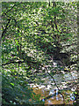
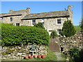
Living in DL13 1YZ means being part of a small, tightly knit residential cluster in England. With a population of 1,466 spread across 14 people per square kilometre, this area offers a quiet, low-density lifestyle. The community is predominantly composed of adults aged 30–64, many of whom own their homes. Over 84% of properties are owner-occupied, reflecting a stable, long-term resident base. The area’s modest size means it is not heavily developed, with no major landmarks or commercial hubs nearby. However, its proximity to Stanhope Railway Station and two primary schools provides practical access to essential services. Daily life here is likely characterised by a relaxed pace, with limited traffic and a focus on local amenities. The low crime risk score of 86/100 and absence of environmental constraints such as protected woodlands or flood-prone zones further support a sense of security. For those seeking a peaceful, family-friendly environment with minimal urban pressures, DL13 1YZ presents a straightforward, uncluttered living option.
- Area Type
- Postcode
- Area Size
- Not available
- Population
- 1466
- Population Density
- 14 people/km²
DL13 1YZ is primarily an owner-occupied area, with 84% of properties owned by their residents rather than rented. This high rate of home ownership suggests a stable, long-term resident base, with limited turnover in the housing market. The accommodation type is predominantly houses, which is unusual for areas with higher population densities. This mix of low-density housing and high ownership rates points to a community that values private, spacious living over shared or rental properties. For buyers, this means the available housing stock is likely to be limited to individual homes rather than apartments or flats. The small area’s size means that the immediate surroundings may offer more options, but buyers should consider expanding their search beyond DL13 1YZ itself. The lack of commercial or industrial development in the area also suggests that property values are unlikely to be driven by speculative investment, focusing instead on residential appeal.
House Prices in DL13 1YZ
No properties found in this postcode.
Energy Efficiency in DL13 1YZ
The nearest amenities to DL13 1YZ include two Co-op stores—Co-op St and Co-op Stanhope—providing basic retail and grocery needs. These shops likely serve the local community with essentials, though the absence of larger supermarkets or specialty stores suggests a focus on convenience over variety. The Stanhope Railway Station offers access to public transport, enabling travel to nearby towns or cities. Beyond retail and transport, the area appears to lack detailed information on parks, leisure facilities, or dining options. This implies a lifestyle centred on local essentials rather than extensive recreational choices. The limited amenities reflect the area’s small scale, with residents potentially relying on nearby towns for more diverse services. For those valuing simplicity and proximity to basic services, DL13 1YZ offers a functional, low-maintenance lifestyle.
Amenities
Schools
Residents of DL13 1YZ have access to two primary schools within practical reach: St John’s Chapel Primary School and Wearhead Primary School. Both institutions hold a ‘good’ Ofsted rating, indicating a standard of education that meets or exceeds national benchmarks. The presence of two primary schools nearby offers families flexibility in choosing a school, though the absence of secondary schools in the immediate area may require students to travel further for higher education. The availability of two primary schools with consistent quality ratings suggests a focus on early education within the community. For families prioritising proximity to schools, DL13 1YZ provides a reliable option, though broader educational needs may necessitate additional planning.
| Rank | School | Type | Entry gender | Ages |
|---|
Explore more schools in this area
Go to Schools tabDemographics
DL13 1YZ is a community defined by its older demographic profile, with a median age of 47 and the majority of residents falling within the 30–64 age range. This suggests a population largely composed of established professionals and families, rather than students or younger workers. Home ownership is exceptionally high at 84%, indicating a preference for long-term residency over rental properties. The area is dominated by houses rather than flats, which aligns with the predominantly older age group’s housing preferences. Ethnically, the population is predominantly White, with no data suggesting significant diversity. The low population density of 14 people per square kilometre implies a spread-out, semi-rural character, which may contribute to a quieter, more private lifestyle. While this demographic profile suggests a stable community, it also means limited intergenerational diversity, which could affect local services and social dynamics.
Household Size
Accommodation Type
Tenure
Ethnic Group
Religion
Household Composition
Age
Household Deprivation
NS-SEC
Explore more demographic insights in this area
Go to Demographics tabPlanning
Planning Constraints
- Flood RiskPremium
- Ramsar Wetland SitesPremium
- Area of Outstanding Natural BeautyPremium
- Protected Nature ReservePremium
- Protected WoodlandPremium